
Buckhead in Atlanta in Fulton County, Georgia — The American South (South Atlantic)
The Battle of Peachtree Creek
July 20, 1864
| — | Tablet #1 | — |
Photographed by Brandon Fletcher, July 23, 2008
1. The Battle of Peachtree Creek Marker
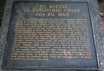
The battle of Peachtree Creek was the first of three desperate Confederate attacks on the armies commanded by Maj. General Wm. T. Sherman which were closing in on Atlanta. Although heavy skirmishing occurred between the Federal right and the Confederate left, which extended west to Moore´s Mill Road, and other forces were engaged east of Atlanta, the actual battle was fought along a two - mile front extending from Clear Creek (east of Brookwood Hills) to Howell Mill Road along Collier and Northfleet raods, one of the most costly here along Tanyard Branch at Collier Mill. After 70 days of slow retreat Dalton (88 miles N), forcing the enemy to fight for every mile, Gen. Joseph E. Johnston´s Confederate Army of Tennessee (Hardee´s, Hood´s and Stewart´s corp. and Wheeler´s cavalry corps) crossed the Chattahoochee River at Bolton late on July 9th and retires toward Atlanta. Although Atlanta was encircled by 12 miles of forts and parapets which Sherman termed "unassailable", Johnston was not ready to use them. He watched closely for the time when Sherman´s stronger forces would cross upriver to approach Atlanta beyond mutual
this page online
Erected 1964 by Georgia Historic Commission - Georgia Civil War Centennial Commission.
Topics. This historical marker is listed in this topic list: War, US Civil. A significant historical month for this entry is July 1863.
Location. 33° 48.628′ N, 84° 24.185′ W. Marker is in Atlanta, Georgia, in Fulton County. It is in Buckhead. It can be reached from the intersection of Collier Road NW and Walthall Drive NW, on the left when traveling west. Located along the Beltline Trail in Tanyard Creek Park. Touch for map. Marker is in this post office area: Atlanta GA 30318, United States of America. Touch for directions.

Regionally, this marker is in Georgia’s Piedmont. It is also in the American South and specifically in the Deep South. Globally, it is in North America, the Western Hemisphere, the Western World, and the Anglosphere. Historically, it finds itself in what was once the territory of the Mississippian
Photographed by Brandon Fletcher, July 23, 2008
2. The Battle of Peachtree Creek Marker
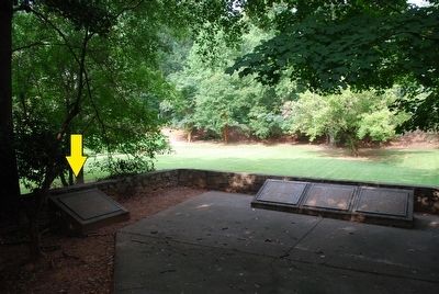
(yellow arrow)
Other nearby markers. At least 8 other markers are within walking distance of this marker: The Federal Forces Engaged/The Confederate Forces Engaged (here, next to this marker); The Federal Advance (here, next to this marker); The Federal Advance, Cont./The Change of Command (here, next to this marker); The Confederate Attack (here, next to this marker); The Confederate Attack, Cont. (here, next to this marker); Battle of Peach Tree Creek (here, next to this marker); On Geary's Front (within shouting distance of this marker); Scott's Brigade (within shouting distance of this marker). Touch for a list and map of all markers in Atlanta.
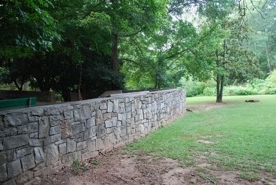
More about this marker. 1 of 6 markers related to the Battle of Peachtree Creek located here. All markers are mounted on concrete pillars and are located in a semi-circular fashioned line, surrounded by a stone wall.
Photographed by Brandon Fletcher, July 23, 2008
3. The Battle of Peachtree Creek Marker
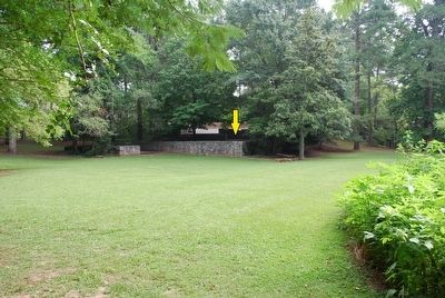
Backside of marker location area (yellow arrow)
Photographed by Brandon Fletcher, July 23, 2008
4. Tanyard Creek Park
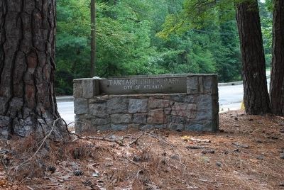
Markers located at Tanyard Creek Park
Photographed by Brandon Fletcher, July 23, 2008
5. The Battle of Peachtree Creek Marker
Markers surrounded by stone wall.
Credits. This page was last revised on February 8, 2023. It was originally submitted on August 15, 2015, by Brandon Fletcher of Chattanooga, Tennessee. This page has been viewed 2,651 times since then and 176 times this year. Photos: 1, 2, 3, 4, 5. submitted on August 15, 2015, by Brandon Fletcher of Chattanooga, Tennessee. • Bernard Fisher was the editor who published this page.
