Buckhead in Atlanta in Fulton County, Georgia — The American South (South Atlantic)
The Federal Advance, Cont./The Change of Command
The Battle of Peachtree Creek
— Tablet #4 —
Inscription.
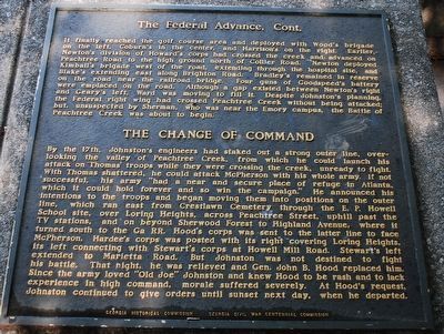
It finally reached the golf course area and deployed with Wood´s brigade on the left, Coburn´s in the center and Harrison´s on the right. Earlier, Newton´s division of Howard´s corps had crossed the creek and advanced on Peachtree Road to the high ground north of Collier Road. Newton deployed Kimball´s brigade west of the road, extending through the hospital site, and Blake´s extending east along Brighton Road. Bradley´s remained in reserve on the road near the railroad bridge. Four guns of Goodspeen´s battery were emplaced on the road. Although a gap existed between Newton´s right and Geary´s left, Ward was moving to fill it. Despite Johnston´s planning, the Federal right wing had crossed Peachtree Creek without being attacked; but, unsuspected by Sherman, who was near the Emory campus, the Battle of Peachtree Creek was about to begin.
By the 17th, Johnston´s engineers had staked out a strong outer line, overlooking the valley of Peachtree Creek, from which he could launch his attack on Thomas´ troops while they crossed the creek, unready to fight. With Thomas shattered, he could attack McPherson with his whole army. If not successful, his army "had a near and secure place of refuge in Atlanta, which he could hold forever and so win the campaign." He announced his intention to the troops and began moving them into positions on the outer line, which ran east from Crestlawn Cemetery through the E. P. Howell School site, over Loring Heights, across Peachtree Street, uphill past the TV station, and on beyond Sherwood Forest to Highland Avenue, where it turned south to the GA RR. Hood´s corps was sent to the latter line to face McPherson. Hardee´s corps was posted with its right covering Loring Heights, its left connecting with Stewart´s corps. at Howell Mill Road. Stewart´s left extended to Marietta Road. But Johnston was not destined to fight his battle. That night, he was relieved and Gen. John B. Hood replaced him Since the army loved "Old Joe" Johnston and knew Hood to be rash and to lack experience in high command, morale suffered severely. At Hood´s request Johnston continued to give orders until sunset next day when he departed.
Erected 1964 by Georgia Historic Commission - Georgia Civil War Centennial Commission.
Topics. This historical marker is listed in this topic list: War, US Civil.
Location. 33° 48.628′ N, 84° 24.185′ W. Marker is in Atlanta, Georgia, in Fulton County. It is in Buckhead. Marker can be reached from the intersection of Collier Rd NW and
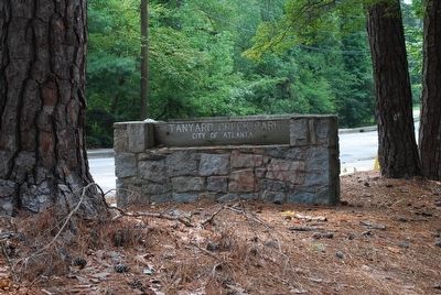
Walthall Drive NW, on the left when traveling west. Located along Beltline Trail in Tanyard Creek Park. Touch for map. Marker is in this post office area: Atlanta GA 30318, United States of America. Touch for directions.
Other nearby markers. At least 8 other markers are within walking distance of this marker. The Federal Forces Engaged/The Confederate Forces Engaged (here, next to this marker); a different marker also named The Federal Advance (here, next to this marker); The Confederate Attack (here, next to this marker); The Confederate Attack, Cont. (here, next to this marker); The Battle of Peachtree Creek (here, next to this marker); Battle of Peach Tree Creek (here, next to this marker); On Geary's Front (within shouting distance of this marker); Scott's Brigade (within shouting distance of this marker). Touch for a list and map of all markers in Atlanta.
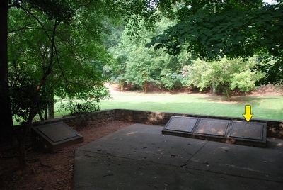
More about this marker. 1 of 6 markers related to the Battle of Peachtree Creek located here. All markers are mounted on concrete pillars and are located in a semi-circular fashioned line, surrounded by a stone wall.
Credits. This page was last revised on February 8, 2023. It was originally submitted on August 15, 2015, by Brandon Fletcher of Chattanooga, Tennessee. This page has been viewed 460 times since then and 12 times this year. Photos: 1, 2, 3, 4, 5. submitted on August 15, 2015, by Brandon Fletcher of Chattanooga, Tennessee. • Bernard Fisher was the editor who published this page.
