Belfield in Stark County, North Dakota — The American Midwest (Upper Plains)
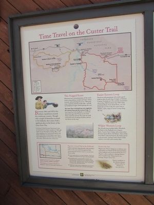
Time Travel on the Custer Trail
Between 1864 and 1876, five military expeditions crossed this windswept country. Though only a couple of skirmishes occurred in the badlands, their stories hold a significant place in the history of the Great Sioux War.
Lieutenant Colonel George Armstrong Custer accompanied two of these expeditions. Although Custer was not the highest ranking officer with either expedition, his controversial exploits and death at the Little Bighorn gave him a more enduring place in history than many officers of his time – hence the name of this tour.
This rugged Route
Historians have retraced portions of the travel routes using military records and maps, letters, journals, and archeological surveys. Along the route, watch for remnants of the trail – ruts left by hundreds of wagon wheels passing this way.
The Auto Tour is divided into two segments, the eastern loop and the western loop. Itís easy to get lost in the badlands, so watch for directional signs thatíll keep you on track. Many roads that intersect the route are roads associated with oil and gas facilities and are not shown on this map.
Easier Eastern Loop
Travel on well-maintained, all-weather gravel roads on this 42-mile loop. It begins at Painted Canyon Overlook on I-94, includes interpretive sites on East Hill Overlook, Easy Hill Camp, and Initial Rock. From Initial Rock, you can backtrack to I-94 or take the scenic loop to Medora, with a stop at Custerís Camp along the way.
Wilder Western Loop
This 38-mile loop includes Sullyís Waterhole, the Battle of the Badlands site at Square Butte, Custerís Snow Camp, and a scenic drive between Butte and Medora. Most of this loop follows well-maintained, all-weather gravel or paved roads. Visiting Custerís Snow Camp requires a two-mile cross-country hike.
Topics. This historical marker is listed in these topic lists: Roads & Vehicles • Wars, US Indian. A significant historical year for this entry is 1864.
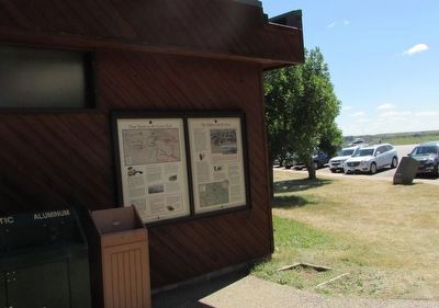
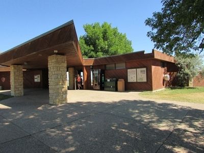
Location. 46° 53.728′ N, 103° 22.893′ W. Marker is in Belfield, North Dakota, in Stark County. Marker is on Interstate 94, on the right when traveling west. Marker is located on the Painted Canyon Visitor Center in Theodore Roosevelt National Park. Touch for map. Marker is in this post office area: Belfield ND 58622, United States of America. Touch for directions.
Other nearby markers. At least 8 other markers are within 7 miles of this marker, measured as the crow flies. The Soldiers and the Sioux (here, next to this marker); The Badlands (within shouting distance of this marker); Welcome to Painted Canyon Ė A View into Theodore Roosevelt National Park (within shouting distance of this marker); Dude on the Frontier (about 300 feet away, measured in a direct line); Invasion Confronted (about 300 feet away); Invader on the Badlands (about 300 feet away); North Dakota Badlands (approx. 5.9 miles away); Von Hoffman House (approx. 6.8 miles away). Touch for a list and map of all markers in Belfield.
More about this marker. The top of the marker features a map of the two Custer Trail tour loops and indicates the location of sites of interest. These include on the eastern loop: Painted Canyon Visitor Center, Easy Hill Overlook, Easy Hill Camp, Initial Rock, Custer Camp, and Medora Visitor Center. The western loop includes: Sentinel Butte, Sullyís Waterhole, Square Butte, Battle of the Badlands, and Custerís Snow Camp.
Credits. This page was last revised on June 16, 2016. It was originally submitted on August 15, 2015, by Bill Coughlin of Woodland Park, New Jersey. This page has been viewed 572 times since then and 23 times this year. Photos: 1, 2, 3. submitted on August 15, 2015, by Bill Coughlin of Woodland Park, New Jersey.


