Chester in Chesterfield County, Virginia — The American South (Mid-Atlantic)
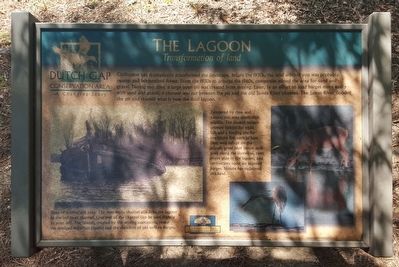
The Lagoon
Transformation of Land
— Dutch Gap Conservation Area - A Changing Story —
Tempered by time and nature, this area teems with wildlife. The sunken barges provide habitat for small fish and a feeding site for predatory fish such as bass. Deer seek refuge i on the islands, great blue heron stalk prey along the shoreline, river otters play in the lagoon, and cormorants roost on exposed barges. Nature has reclaimed this land.
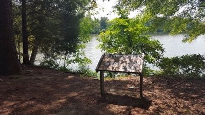
Signs of mining still exists. The man-made channel still links the lagoon to the old river channel. One end of the channel can be seen slightly to your left. The islands, created by the mining operations, reveal the dredged materials (spoils) and the skeletons of old sunken barges.
Erected by Dutch Gap Conservation Area, Chesapeake Bay Gateways Network.
Topics. This historical marker is listed in these topic lists: Environment • Industry & Commerce • Man-Made Features. A significant historical year for this entry is 1930.
Location. 37° 22.001′ N, 77° 22.244′ W. Marker is in Chester, Virginia, in Chesterfield County. Marker can be reached from Henricus Park Road, 1.3 miles east of Coxendale Road. Touch for map. Marker is at or near this postal address: 251 Henricus Park Road, Chester VA 23836, United States of America. Touch for directions.
Other nearby markers. At least 8 other markers are within walking distance of this marker. John Smith Explores the Chesapeake (approx. 0.6 miles away); Join the Adventure (approx. 0.6 miles away); Ill-Fated Friendship (approx. 0.6 miles away); John N. Pastore, D.D.S. (approx. 0.7 miles away); Citie of Henricus (approx. 0.7 miles away); Chief Opechancanouch (approx. 0.7 miles away); The Bermuda Hundred Campaign (approx. 0.7 miles away); a different marker also named The Bermuda Hundred Campaign (approx. 0.7 miles away). Touch for a list and map of all markers in Chester.
Also see . . .
1. Dutch Gap Conservation Area. Chesterfield County Parks & Recreation. (Submitted on August 30, 2015.)
2. Chesapeake Bay Gateways and Watertrails Network. National Park Service (Submitted on August 30, 2015.)
Credits. This page was last revised on June 16, 2016. It was originally submitted on August 30, 2015, by Bernard Fisher of Richmond, Virginia. This page has been viewed 259 times since then and 12 times this year. Photos: 1, 2. submitted on August 30, 2015, by Bernard Fisher of Richmond, Virginia.

