Chester in Chesterfield County, Virginia — The American South (Mid-Atlantic)
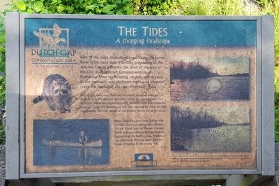
The Tides
A changing landscape
— Dutch Gap Conservation Area - A Changing Story —
During low tides, mud flats and shorelines are more exposed. Birds such as the spotted sandpiper probe the exposed mud and shoreline for worms, crustaceans and fish. Raccoons and opossums scavenge along the shoreline at low tides looking for food. At high tide, smaller fish find refuge in the shallow waters along the shore.
Many fishermen time their fishing with the tide. During outgoing tides, smaller fish are forced into the deeper channels where larger, predatory fish are feeding. Recognizing this feeding time, fishermen cast their lures into the water with hopes of reeling in a trophy fish.
(caption)
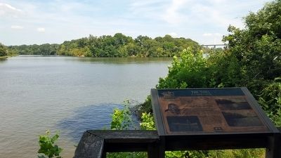
(lower right) Though separated by nearly 80 nautical miles from the Chesapeake Bay and the Atlantic Ocean, the Dutch Gap Conservation Area experiences a tidal change of 3 to 3½ feet. The photographs reveal the difference between low and high tide.
Erected by Dutch Gap Conservation Area, Chesapeake Bay Gateways Network.
Topics. This historical marker is listed in these topic lists: Environment • Waterways & Vessels.
Location. 37° 22.6′ N, 77° 21.631′ W. Marker is in Chester, Virginia, in Chesterfield County. Marker can be reached from Henricus Park Road, 1.3 miles east of Coxendale Road. Located in Henricus Historical Park 300 yards north of the parking lot. Touch for map. Marker is in this post office area: Chester VA 23836, United States of America. Touch for directions.
Other nearby markers. At least 8 other markers are within walking distance of this marker. Dutch Gap (here, next to this marker); The James River...Floating Through The Centuries (here, next to this marker); Mount Malady (here, next to this marker); USCTs At Dutch Gap (within shouting distance of this marker); Dutch Gap Canal (within shouting distance of this marker); The Bermuda Hundred Campaign (within shouting distance of this marker); The Lightkeeper’s House (within shouting distance of this marker); Henricopolis (within shouting distance of this marker). Touch for a list and map of all markers in Chester.
Also see . . .
1. Dutch Gap Conservation Area. Chesterfield County Parks & Recreation. (Submitted on August 30, 2015.)
2. Chesapeake Bay Gateways and Watertrails Network. National Park Service (Submitted on August 30, 2015.)
Credits. This page was last revised on June 16, 2016. It was originally submitted on August 30, 2015, by Bernard Fisher of Richmond, Virginia. This page has been viewed 374 times since then and 11 times this year. Photos: 1, 2, 3. submitted on August 30, 2015, by Bernard Fisher of Richmond, Virginia.


