Near Newell in Modoc County, California — The American West (Pacific Coastal)
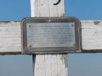
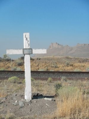
Warm Springs Indians
Topics. This historical marker is listed in these topic lists: Native Americans • Wars, US Indian. A significant historical date for this entry is May 10, 1873.
Location. 41° 52.737′ N, 121° 21.88′ W. Marker is near Newell, California, in Modoc County. Marker is on California Route 139 near County Route 122, on the left when traveling north. Touch for map. Marker is in this post office area: Tulelake CA 96134, United States of America. Touch for directions.
Other nearby markers. At least 8 other markers are within 4 miles of this marker, measured as the crow flies. Captain Jack’s Stronghold (about 400 feet away, measured in a direct line); Canby’s Cross (about 400 feet away); Battle of Dry Lake Memorial (about 500 feet away); Tule Lake Segregation Center (approx. 0.7 miles away); Tule Lake (approx. 0.7 miles away); Petroglyph Point (approx. 2.8 miles away); Raptors - Birds of Prey (approx. 2.8 miles away); Burnett Cutoff - Muddy Waters (approx. 3.7 miles away). Touch for a list and map of all markers in Newell.
Additional keywords. Modoc War
Credits. This page was last revised on June 16, 2016. It was originally submitted on August 30, 2015, by Barry Swackhamer of Brentwood, California. This page has been viewed 405 times since then and 14 times this year. Photos: 1, 2. submitted on August 30, 2015, by Barry Swackhamer of Brentwood, California.

