Donegal in County Donegal, Ulster, Ireland — North West ((Éire) North Atlantic Ocean)
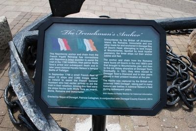
"The Frenchman's Anchor"
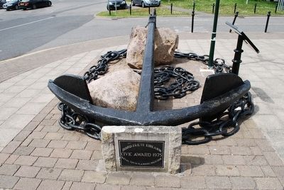
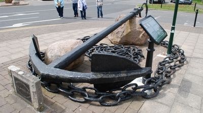
This Napoleonic anchor and chain from the French frigate Romaine has connections with Napoleon's failed invasion to assist the Irish in the 1798 rebellion, Irish patriot Wolfe Tone's arrest and subsequent death and in later years Admiral Horatio Nelson's famous Battle of Trafalgar.
In September 1798 a small French fleet of about 12 ships and 2,900 troops sailed to Ireland to assist the French General Humbert who had earlier arrived to the Irish in their rebellion. Among the fleet were the ships Hoche (with Wolfe Tone on board), Biche, Romaine and Immortalité.
Encountered by the British off Arranmore Island, the Romaine, Immortalité and one other made for an anchored in Donegal Bay off Doorin Head, attempting to land troops at Mountcharles. Spotted by local loyalist yeomanry, the three ships cut their anchor cables and fled.
The anchor and chain from the Romaine were found off Doorin in the mid 1800's and first brought to Mountcharles pier, and then to the old Abbey shoreline at Donegal Town. Eventually, in 1951, they were moved to Donegal Town's Diamond and in later years placed in their present location at the pier.
The Hoche was captured by the British and renamed 'HMS Donegal', taking part in many historic sea battles in Admiral Nelson's fleet during subsequent years.
With thanks to Paddy Meehan for historic information.
Erected by Mayor of Donegal, Patricia Callaghan, in conjunction with Donegal County Council, 2014
Topics. This historical marker is listed in these topic lists: Wars, Non-US • Waterways & Vessels. A significant historical month for this entry is September 1798.
Location. 54° 39.146′ N, 8° 6.684′ W. Marker is in Donegal, Ulster, in County Donegal. Marker is on Quay Street, on the left when traveling north. Touch for map. Touch for directions.
Other nearby markers. At least 7 other markers are within 19 kilometers of this marker, measured as the crow flies. Donegal Castle / Caisleán Dhún na nGall (approx. 0.3 kilometers away); Donegal Castle (approx. 0.3 kilometers away); Donegal Friary / Mainistir Dhún na nGall (approx. 0.3 kilometers away); The Franciscan Friary of Donegal (approx. 0.3 kilometers away); Welcome to Belleek (approx. 19.3 kilometers away in United Kingdom); Donegal Corridor (approx. 19.3 kilometers away in United Kingdom); The Enamel Grindstone (approx. 19.3 kilometers away in United Kingdom).
Credits. This page was last revised on June 16, 2016. It was originally submitted on September 7, 2015, by Brandon Fletcher of Chattanooga, Tennessee. This page has been viewed 614 times since then and 42 times this year. Photos: 1, 2, 3. submitted on September 7, 2015, by Brandon Fletcher of Chattanooga, Tennessee. • Andrew Ruppenstein was the editor who published this page.


