
Port Republic in Rockingham County, Virginia — The American South (Mid-Atlantic)
The Point
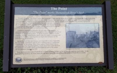
“The Point” marks Shenandoah River’s birth
Photographed by Bernard Fisher, September 11, 2015
1. The Point Marker
Gundalow construction took place on both sides of the river here. A gundalow, typically 60 to feet long and 9½ feet wide, could be built for as little as $6 or as much as $600. A variety of goods, including wooden scantling, whiskey, tanned leather, grains, pig iron, copper, manganese, and even herds of turkeys, were hauled in by wagon and stockpiled on The Point awaiting transportation.
During the Civil War when bridges and roads were at times
this page online
From the street’s dead-end at North River, evidence of former bridges and an old dam just upstream can be seen. At the dead-end at South River, the lower ford’s site, the bed of one of the two millraces that paralleled South River is visible.
(caption)
Hauling goods down Water Street.
Sign courtesy of the Society of Port Republic Preservationists, Inc. in cooperation with Shenandoah Valley Battlefields National Historic District Commission. Installation by Port Republic Ruritan Club.
Erected by The Society of Port Republic Preservationists, Inc.
Topics. This historical marker is listed in these topic lists: Industry & Commerce • War, US Civil • Waterways & Vessels.
Location. 38° 17.766′ N, 78° 48.581′ W. Marker is
Photographed by Bernard Fisher, September 11, 2015
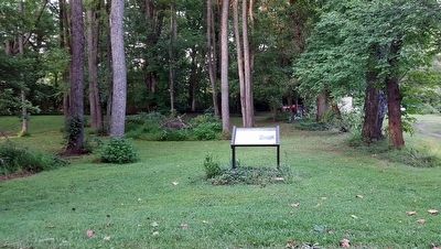
2. The Point Marker

Regionally, this marker is in Virginia’s Shenandoah Valley. It is also in the American South and specifically in the Upper South. Globally, it is in North America, the Western Hemisphere, the Western World, and the Anglosphere. Historically, it finds itself in what was once the territory of the Mississippian Culture, one of the original Thirteen Colonies, one of the Confederate States of America, and the Antebellum South.
Other nearby markers. At least 8 other markers are within 2 miles of this marker, measured as the crow flies: North River Bridge (about 300 feet away, measured in a direct line); Port Republic Battlefield (about 400 feet away); a different marker also named The Frank Kemper House (about 400 feet away); Palmer Lot at Middle Ford (approx. ¼ mile away); a different marker also named Riverside Graveyard (approx. 0.4 miles away); a different marker also named Madison Hall (approx. 0.6 miles away); Battle of Port Republic (approx. 1.4 miles away); First Confederate Advance (approx. 2.1 miles away). Touch for a list and map of all markers in Port Republic.
Other markers no longer nearby. North River Bridge (was about 300 feet away but has been replaced with another marker now near it); Shenandoah Valley Battlefields Historic District (was about 400 feet away but has been replaced with another marker now near it); The Frank Kemper House (was about 400 feet away but has been replaced with another marker now near it); Riverside Graveyard (was approx. 0.4 miles away but has been replaced with another marker now near it); Port Republic Foundry (was approx. half a mile away but has been confirmed missing); Madison Hall (was approx. 0.6 miles away but has been replaced with another marker now near it).
Also see . . . Port Republic Museum. The Society of Port Republic Preservationists, Inc. (Submitted on September 13, 2015.)
Credits. This page was last revised on June 16, 2016. It was originally submitted on September 13, 2015, by Bernard Fisher of Richmond, Virginia. This page has been viewed 1,021 times since then and 34 times this year. Photos: 1, 2. submitted on September 13, 2015, by Bernard Fisher of Richmond, Virginia.
