
Medora in Billings County, North Dakota — The American Midwest (Upper Plains)
Building From Hard Times
Photographed by Bill Coughlin, July 20, 2015
1. Building From Hard Times Marker
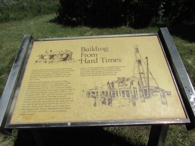
The drought and depression of the 1930’s hit the badlands region hard. Small landowners, no longer able to eke out a living, sold their lands to the government with the hope of finding a new start elsewhere. Throughout the country, men were out of work.
National relief programs, such as the Civilian Conservation Corps (C.C.C.), Emergency Relief Administration (E.R.A.), and Works Progress Administration (W.P.A.), were created to employ men and to accomplish conservation projects. Here in the badlands during the years 1934 to 1941, C.C.C. Companies 2767, 2771, and 2772 worked on projects on land now included in Theodore Roosevelt National Park and the DeMores State Historic Site at Medora. Under the supervision of the Army and with the input of the National Park Service, the C.C.C. men built roads, trails, shelters, signs, picnic areas, and campgrounds, and accomplished conservation work. The E.R.A. and W.P.A. men worked on related projects.
Today, we may admire their accomplishments for the hard work and skills that they represent. More importantly, they remind us of the lessons to be learned from the Thirties: the need for
this page online
Erected by National Park Service, U.S. Department of the Interior.
Topics and series. This historical marker is listed in these topic lists: Charity & Public Work • Environment • Man-Made Features. In addition, it is included in the Civilian Conservation Corps (CCC), and the Works Progress Administration (WPA) projects series lists.
Location. 46° 57.99′ N, 103° 29.222′ W. Marker is in Medora, North Dakota, in Billings County. It is on E River Road, on the right when traveling north. Marker is located in the South Unit of Theodore Roosevelt National Park. Touch for map. Marker is in this post office area: Medora ND 58645, United States of America. Touch for directions.

Regionally, this marker is on North Dakota’s Missouri Plateau. It is also in the American Lewis & Clark Corridor, on the prairies, and on the Northern Plains. Globally, it is in North America, the Western Hemisphere, the Western World, and the Anglosphere. Historically, it finds itself in what was once Rupert’s Land and also the Louisiana
Photographed by Bill Coughlin, July 20, 2015
2. Building From Hard Times Marker
Other nearby markers. At least 8 other markers are within 4 miles of this marker, measured as the crow flies: Beef Corral Bottom (approx. 0.9 miles away); North Dakota Badlands (approx. 1.7 miles away); Historic Medora—Boom and Bust (approx. 3.7 miles away); On Track to Adventure (approx. 3.8 miles away); The Shooting of Riley Luffsey (approx. 3.9 miles away); In honor of a President . . . and His Conservation Legacy (approx. 3.9 miles away); Stephen Tyng Mather (approx. 3.9 miles away); Coal Mining (approx. 4 miles away). Touch for a list and map of all markers in Medora.
Other markers no longer nearby. Wind Canyon – Carved by Wind and Water – Marred by Man (was approx. 1½ miles away but has been confirmed missing); River Woodland (was approx. 2.6 miles away but has been confirmed missing); Historic Medora (was approx. 3.8 miles away but has been permanently removed).
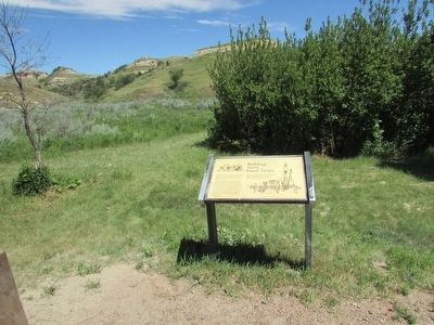
More about this marker. Pictures of CCC workers building a cabin and a road appear on the marker.
Photographed by Bill Coughlin, July 20, 2015
3. Marker in Theodore Roosevelt National Park
Photographed by Bill Coughlin, July 20, 2015
4. Building From Hard Times Marker
Credits. This page was last revised on July 19, 2020. It was originally submitted on September 13, 2015, by Bill Coughlin of Woodland Park, New Jersey. This page has been viewed 474 times since then and 17 times this year. Photos: 1, 2, 3, 4. submitted on September 13, 2015, by Bill Coughlin of Woodland Park, New Jersey.
