Hopkinsville in Christian County, Kentucky — The American South (East South Central)
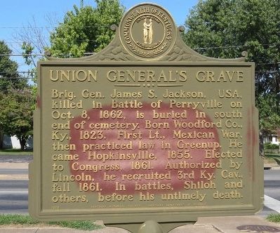
Union General's Grave
Erected 1965 by Kentucky Historical Society Kentucky Department of Highways. (Marker Number 882.)
Topics and series. This historical marker is listed in these topic lists: Cemeteries & Burial Sites • Government & Politics • War, Mexican-American • War, US Civil. In addition, it is included in the Kentucky Historical Society series list. A significant historical year for this entry is 1862.
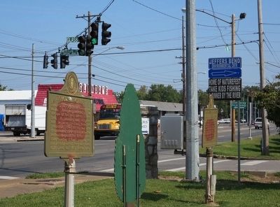
Location. 36° 52.543′ N, 87° 28.991′ W. Marker is in Hopkinsville, Kentucky, in Christian County. Marker is at the intersection of North Main Street and Clark Avenue, on the right when traveling north on North Main Street. Touch for map. Marker is at or near this postal address: 530 North Main Street, Hopkinsville KY 42240, United States of America. Touch for directions.
Other nearby markers. At least 8 other markers are within walking distance of this marker. Famous Prophet (here, next to this marker); Hdqrs. CSA Commander / 101 CSA Unknown (a few steps from this marker); Latham Confederate Monument (approx. 0.2 miles away); Round Table Literary Park (approx. half a mile away); Forrest Reconnoitered (approx. 0.6 miles away); County Named, 1797 (approx. 0.7 miles away); Confederate Memorial Fountain (approx. 0.7 miles away); Lewis and Clark in Kentucky (approx. 0.7 miles away). Touch for a list and map of all markers in Hopkinsville.
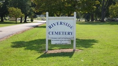
Also see . . . Blog story about cemetery. (Submitted on September 23, 2015, by Mark Hilton of Montgomery, Alabama.)
Credits. This page was last revised on February 26, 2024. It was originally submitted on September 23, 2015, by Mark Hilton of Montgomery, Alabama. This page has been viewed 445 times since then and 25 times this year. Photos: 1, 2, 3, 4. submitted on September 23, 2015, by Mark Hilton of Montgomery, Alabama.


