Near Frederick in Frederick County, Maryland — The American Northeast (Mid-Atlantic)
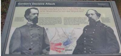
Gordonís Decisive Attack
3:00-4:30 p.m. July 9, 1864
ó Monocacy National Battlefield, National Park Service, U.S. Department of the Interior ó
So profuse was the flow of blood from the killed and wounded of both sides of these forces that it reddened the stream [on the Thomas Farm] for more than 100 yards below.
Maj. Gen. John B. Gordon
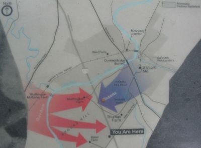
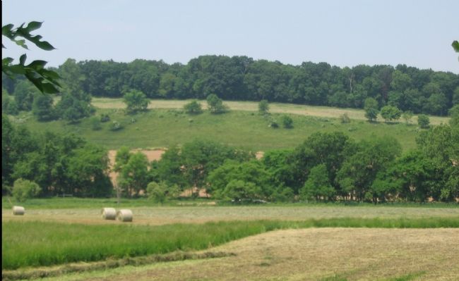
The first Confederate troops to cross the Monocacy River had been repulsed by the Federals massing across the Thomas farm. Then Maj. Gen. John B. Gordon's infantry emerged over the crest of Brooks Hill and with rebel yells and flying banners, swept down the hill toward the farm.
Gordon ordered his three brigades to attack sequentially from right to left. Union volleys ravaged the first brigade and bloodied the second. But the third brigade and other Confederate units drove the Federals off the Thomas farm and forced them into a general retreat toward Gambrill Mill.
Erected by National Park Service, U.S. Department of the Interior.
Topics. This historical marker is listed in this topic list: War, US Civil. A significant historical month for this entry is July 1863.
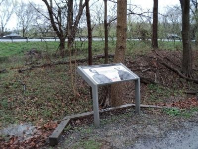
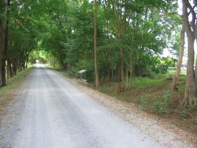
Location. Marker has been reported missing. It was located near 39° 21.287′ N, 77° 23.681′ W. Marker was near Frederick, Maryland, in Frederick County. Marker was on Monocacy National Park Service Road, on the right when traveling north. Located on the service road leading to the Worthington Farm (tour stop three). The stop is reached by turning north off Baker Valley Road after crossing under the I 270 overpasses. The marker stands between the service road and I-270. Touch for map. Marker was in this post office area: Frederick MD 21704, United States of America. Touch for directions.
Other nearby markers. At least 8 other markers are within walking distance of this location. Final Attack (approx. ľ mile away); Civilians Under Siege (approx. ľ mile away); History of the Monocacy River Valley (approx. 0.4 miles away); Clustered Spires of Frederick (approx. 0.4 miles away); The Battle That Saved Washington (approx. 0.4 miles away); 10th Vermont Monument (approx. 0.6 miles away); Final Stand (approx. 0.6 miles away); State of Pennsylvania Monument (approx. 0.6 miles away). Touch for a list and map of all markers in Frederick.
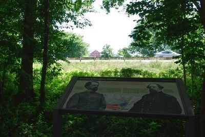
More about this marker. On the left is a portrait of "Georgia's John B. Gordon" who "was a gallant, determined, and inspiring leader - just what the Confederates needed at the critical point in the Battle of Monocacy." On the right is a portrait of "Union Brig. Gen. James B. Rickets," who "moved quickly across the Thomas farm to confront Gordon's flanking movement. His division suffered heavy losses but did stall the Confederates." Between the portraits is a tactical battle map.
Regarding Gordonís Decisive Attack.
The Monocacy Battlefield, while otherwise rather pristine compared to other major battlefields, is bisected by US Interstate 270 at this point. The highway creates an unnatural line between the fighting on the Thomas Farm and the Confederate advance from the Worthington Farm/Brooks' Hill.
Related markers. Click here for a list of markers that are related to this marker. This marker is among several describing the battle of Monocacy, to "tour" the battlefield using the related HMBd markers sites.
Also see . . . Battle of Monocacy. National Park Service site. (Submitted on November 4, 2007, by Craig Swain of Leesburg, Virginia.)
Credits. This page was last revised on April 25, 2024. It was originally submitted on November 4, 2007, by Craig Swain of Leesburg, Virginia. This page has been viewed 1,808 times since then and 18 times this year. Last updated on October 1, 2015, by Shane Oliver of Richmond, Virginia. Photos: 1. submitted on November 4, 2007, by Craig Swain of Leesburg, Virginia. 2. submitted on April 23, 2011, by Bill Coughlin of Woodland Park, New Jersey. 3, 4. submitted on November 4, 2007, by Craig Swain of Leesburg, Virginia. 5. submitted on August 9, 2015, by Brandon Fletcher of Chattanooga, Tennessee. 6. submitted on November 4, 2007, by Craig Swain of Leesburg, Virginia. • Andrew Ruppenstein was the editor who published this page.
