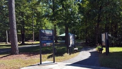
Charles City in Charles City County, Virginia — The American South (Mid-Atlantic)
Captain John Smith’s Trail on the James
North Panel
Inscription.
(left panel)
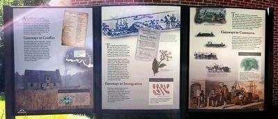
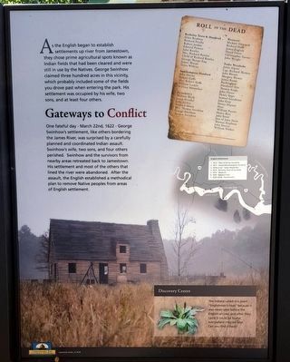
Gateways to Conflict
As the English began to establish settlements up river from Jamestown, they chose prime agricultural spots known as Indian fields that had been cleared and were still in use by the Natives. George Swinhow claimed three hundred acres in this vicinity, which probably included some of the fields you drove past when entering the park. His settlement was occupied by his wife, two sons and at least four others.
One fateful day - March 22nd, 1622 – George Swinhow's settlement, like others bordering the James River, was surprised by a carefully planned and coordinated Indian assault. Swinhow's wife, two sons, and four others perished. Swinhow and the survivors from nearby areas retreated back to Jamestown. His settlement and most of the others that lined the river were abandoned. After the assault, the English established a methodical plan to remove Native peoples from areas of English settlement.
Discovery Center
The Indians called this plant “Englishman's Foot” because it was never seen before the English arrived, and after they came it could be found everywhere they set foot. Can you find it here?
Plantain
(caption)
“The New World” MMV New Line Productions, Inc. All rights reserved. Photo by Marie Wallace. Photo appears courtesy of New Line Productions, Inc.
(center panel)
Gateways to Immigration
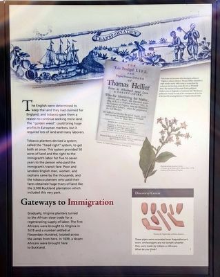
The English were determined to keep the land they had claimed for England, and tobacco gave them a reason to continue seeking more land. The "golden weed" could bring huge profits in European markets, but it required lots of land and many laborers.
Tobacco planters devised a system called the "head right" system, to get both at once. This system provided 50 acres of land and the right to the immigrant's labor for five to seven years to the person who paid the immigrant's transit fare. Poor and landless English men, women, and orphans came by the thousands, and the tobacco planters who paid their fares obtained huge tracts of land like the 3,500 Buckland plantation which included this park.
Gradually, Virginia planters turned to the African slave trade for a regenerating supply of labor. The first Africans were brought to Virginia in 1619 and a number settled at Flowerdew Hundred, located across the James from here. In 1639, a dozen Africans were brought here to Buckland.
Discovery Center
These pipes were excavated near Kaquothocun's town. Archeologists are not certain whether they were made by Indians or Africans. Courtesy the Virginia Dept. of Historic Resources. What do you think?
(captions)
Handkerchief detail ca 1770. Courtesy The Colonial Williamsburg Foundation.
False hope and promises often lured poor whites to Virginia as tobacco laborers. Thomas Hellier committed a triple murder nearby while trying to escape from his indenture and was hung across the river at Windmill Point. The minister of Weyanoke Parish published Hellier’s story in England as a “cautionary tale.” This famous publication warned not only of the consequences of sin, but of the hard life awaiting laborers in Virginia tobacco fields. Courtesy the Virginia Historical Society, Richmond, Va.
Illustration from Jonathan Carver, A Treatise on the Culture of the Tobacco Plant, 1779. Courtesy of The Library of Virginia.
(right panel)
Gateways to Commerce
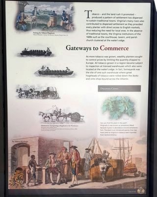
Tobacco - and the land rush it promoted - produced a pattern of settlement too dispersed to sustain traditional towns. Virginia's many rivers also contributed to dispersed settlement as they provided every planter with direct access to English markets, thus reducing the need for local ones. In the absence of traditional towns, the Virginia institutions of the 1600s such as the courthouse, tavern, and parish church clustered at the water’s edge.
As more tobacco was grown, wealthy planters sought to control prices by limiting the quantity shipped to Europe. All tobacco grown in a region became subject to inspection at licensed warehouses which also were located at the water's edge. In fact, Swineyards was the site of one such warehouse where great hogsheads of tobacco were rolled down the docks and onto ships bound across the Atlantic.
Discovery Center
Can you find this plant in the park?
Originally it was known as Jamestown Weed because it-grew in abundance around Jamestown Fort. The plant is an introduced species that may have come to Virginia in tobacco seed imported from Central America.
Jimsonweed
(captions)
Packing the Tobacco Hogshead. Tobacco Plantation. Courtesy The Mariners’ Museum, Newport News, Va.
Methods for Transporting a Hogshead to the Warehouse. Illustrations from William Tarum. An Historical and Practical Essay on the Culture and Commerce of Tobacco, 1800. Courtesy Library of Virginia.
The Tobacco Warehouse. Fry-Jefferson map 1751. Courtesy The Library of Virginia.
Erected by Chesapeake Bay Gateways Network, Charles City County, Lawrence Lewis Jr. Park. (Marker Number 20.)
Topics. This historical marker is listed in these topic lists: Colonial Era • Exploration • Native Americans • Settlements & Settlers. A significant historical date for this entry is March 22, 1622.
Location. 37° 19.163′ N, 77° 5.942′ W. Marker is in Charles City, Virginia, in Charles City County. Marker is on Wilcox Wharf Road, one mile south of John Tyler Memorial Highway (Virginia Route 5), on the right when traveling south. Located in Lawrence Lewis, Jr. Park. Touch for map. Marker is at or near this postal address: 12400 Wilcox Wharf Road, Charles City VA 23030, United States of America. Touch for directions.
Other nearby markers. At least 8 other markers are within 3 miles of this marker, measured as the crow flies. A different marker also named Captain John Smith’s Trail on the James (here, next to this marker); John Smith Explores the Chesapeake (approx. 0.2 miles away); Wilcox’s Landing (approx. 0.2 miles away); Swineyards - Willcox Wharf (approx. one mile away); Grant's Crossing (approx. one mile away); John Tyler's Birthplace (approx. 1.7 miles away); Eye Witness to a Revolution (approx. 2.1 miles away); Shifting Ground (approx. 2.1 miles away). Touch for a list and map of all markers in Charles City.
Also see . . .
1. Chesapeake Explorer. National Park Service (Submitted on October 12, 2015.)
2. Captain John Smith Chesapeake National Historic Trail. National Park Service (Submitted on October 12, 2015.)
Photographed By Bernard Fisher
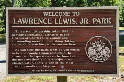
6. Welcome to Lawrence Lewis, Jr. Park
This park was established in 1993 to provide recreational activities to the citizens of Charles City County and surrounding areas. Enjoy fishing, hiking and wildlife watching while you are here.
As you tour the park, what do you notice to be the county's main resource? The answer to that question can be found at the next overlook and is a major reason Charles City County is one of the most historic counties in Virginia.
This sign funded by VA Coastal Resource Program/NOAA
Photographed By Bernard Fisher
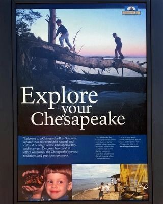
7. Explore your Chesapeake Marker
Welcome to a Chesapeake Bay Gateway, Gateways Network a place that celebrates the natural and cultural heritage of the Chesapeake Bay and its rivers. Discover here, and at other Gateways, the Chesapeake's proud traditions and precious resources.
The Chesapeake Bay Gateways Network unites more than 100 parks, wildlife refuges, maritime museums, historic sites and water trails across the Bay watershed. Visit them all and enjoy the full meaning of the Chesapeake story.
Let us be your guide: take a map of these special places and explore your Chesapeake! Visit us at www.baygateways.net.
Credits. This page was last revised on June 16, 2016. It was originally submitted on October 12, 2015, by Bernard Fisher of Richmond, Virginia. This page has been viewed 503 times since then and 15 times this year. Photos: 1, 2, 3, 4, 5, 6, 7. submitted on October 12, 2015, by Bernard Fisher of Richmond, Virginia.
