Klingerstown in Schuylkill County, Pennsylvania — The American Northeast (Mid-Atlantic)
Tulpehocken Path
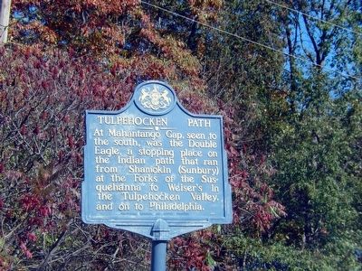
Photographed by Don Morfe, October 11, 2015
1. Tulpehocken Path Marker
Erected 1950 by Pennsylvania Historical & Museum Commission.
Topics and series. This historical marker is listed in these topic lists: Indigenous Peoples and Communities • Roads & Vehicles. In addition, it is included in the Pennsylvania Historical and Museum Commission (PHMC) series list.
Location. 40° 40.232′ N, 76° 42.139′ W. Marker is in Klingerstown, Pennsylvania, in Schuylkill County. It is on Pennsylvania Route 3016. Touch for map. Marker is in this post office area: Klingerstown PA 17941, United States of America. Touch for directions.

Regionally, this marker is in Anthracite Coal Region. It is also in the American Northeast, in the Mid-Atlantic, in Appalachia, and specifically in Northern Appalachia. Globally, it is in North America, the Western Hemisphere, the Western World, and the Anglosphere. Historically, it finds
this page online
Other nearby markers. At least 8 other markers are within 8 miles of this marker, measured as the crow flies: Leonard Reedy (approx. 4.1 miles away); Gratz (approx. 4.6 miles away); Mandata (approx. 6.7 miles away); War Memorial (approx. 6.8 miles away); GAR Building (approx. 7.1 miles away); Lykens (approx. 7.2 miles away); The Romberger-Stover House (approx. 7.4 miles away); Henninger Farm Covered Bridge (approx. 7.7 miles away).
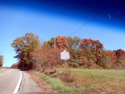
Photographed by Don Morfe, October 11, 2015
2. Tulpehocken Path Marker
Credits. This page was last revised on June 16, 2016. It was originally submitted on October 19, 2015, by Don Morfe of Baltimore, Maryland. This page has been viewed 680 times since then and 37 times this year. Photos: 1, 2. submitted on October 19, 2015, by Don Morfe of Baltimore, Maryland. • Bill Pfingsten was the editor who published this page.
