Muncy in Lycoming County, Pennsylvania — The American Northeast (Mid-Atlantic)
Muncy Mills
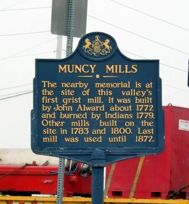
Photographed by Don Morfe, October 12, 2015
1. Muncy Mills Marker
Erected 1947 by Pennsylvania Historical & Museum Commission.
Topics and series. This historical marker is listed in these topic lists: Colonial Era • Indigenous Peoples and Communities • Industry & Commerce. In addition, it is included in the Pennsylvania Historical and Museum Commission (PHMC) series list. A significant historical year for this entry is 1772.
Location. 41° 12.695′ N, 76° 45.482′ W. Marker is in Muncy, Pennsylvania, in Lycoming County. It is at the intersection of Pennsylvania Route 405 and Route 442 on Pennsylvania Route 405. Touch for map. Marker is in this post office area: Muncy PA 17756, United States of America. Touch for directions.

Regionally, this marker is in the Pennsylvania Wilds and in the Susquehanna Valley. It is also in the American Northeast, in the Mid-Atlantic, in Appalachia, and specifically in Northern Appalachia. Globally, it is in North America,
this page online
Other nearby markers. At least 8 other markers are within 2 miles of this marker, measured as the crow flies: Shoemaker Bridge (here, next to this marker); Muncy (approx. 0.9 miles away); Civil War Memorial (approx. 1.4 miles away); The McCartys and the Muncy Historical Society (approx. 1½ miles away); a different marker also named Muncy (approx. 1½ miles away); Main and Water Streets (approx. 1½ miles away); Muncy's Post Office (approx. 1.6 miles away); Capt. John Brady (approx. 1.6 miles away). Touch for a list and map of all markers in Muncy.
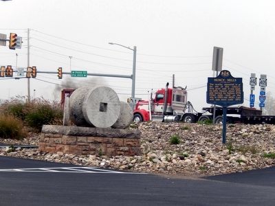
Photographed by Don Morfe, October 12, 2015
2. Muncy Mills Marker
Credits. This page was last revised on June 16, 2016. It was originally submitted on October 24, 2015, by Don Morfe of Baltimore, Maryland. This page has been viewed 705 times since then and 36 times this year. Photos: 1, 2. submitted on October 24, 2015, by Don Morfe of Baltimore, Maryland. • Bill Pfingsten was the editor who published this page.
