Lake Providence in East Carroll Parish, Louisiana — The American South (West South Central)
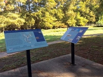
Battle for the Mississippi: The Vicksburg Campaign
Inscription.
Left side
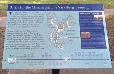
The fall of New Orleans in April 1862, capped the beginning of an 18-month drive to control Vicksburg and the Mississippi River. The fight for this strategic location was arduous. Vicksburg, sitting high atop bluffs, was protected by artillery and a maze of bayous. Confederate river fortifications interrupted the flow of Northern troops, supplies and commerce.
Driving southward from Tennessee and northward from the Gulf, Federal troops forced the surrender of Vicksburg. With this victory, the North opened the Mississippi and dealt a psychological blow to the Confederacy. The South was split in two and unable to move men and munitions across the river. While war's end was still 20 months away, control of the great Mississippi led ultimately to Union victory.
Right side
An 18-Month Campaign
The battle for Vicksburg hit a fevered pitch when Ulysses S. Grant was appointed commander of the Department of the Tennessee and Lt. Gen. John C. Pemberton, a West Point graduate and native of Pennsylvania, was given charge of 50,000 Confederate troops defending the Mississippi. Grant was ordered to clear the river of Confederate resistance and Pemberton to defend it.
Grant planned to draw Confederate troops defending Vicksburg north and pin them down while another column, led by Maj. Gen. William T. Sherman, moved moved south from Memphis. Grant led 40,000 troops from La Grange, Tennessee, toward Grenada, Mississippi, but met fierce resistance from Confederate forces dug into the Yalobusha riverbank to defend the crossing and the railroad. Grant's plan was thwarted.
Confederate cavalry, led by Maj. Gen. Earl Van Dorn, headed northward from Grenada, captured the Federal supply base at Holly Springs, Mississippi,and stopped the Union advance. The Mobile & Ohio Railroad carrying Northern supplies fell to Brig. Gen. Nathan Bedford Forrest's raiders. These events caused Grant to retreat to Memphis. Confederate troops heading south toward Vicksburg engaged and decisively beat, Sherman's forces at Chickasaw Bayou.
Grant launched yet another drive to disrupt Southern communications and transportation, confuse the Confederates, and divert Pemberton's troops. He led his troops 50 miles down the west side of the river from Milliken's Bend, Louisiana to Hard Times. At the same time, Union Col. Benjamin H. Grierson led a brigade of 1,700 cavalry from La Grange through Mississippi to Baton Rouge destroying rolling stock, bridges, trestles, track and telegraph lines during this 16-day, 475-mile ride. He also succeeded in luring Pemberton's cavalry and one infantry division in pursuit.
With
Grant in southern Louisiana, Adm. David D. Porter maneuvered his gunboats into place to secure the river at Grand Gulf, forcing Grant farther down river to cross at Bruinsburg. Grant fought his way towards Vicksburg on the eastern side of the river, overwhelming and scattering Confederate troops. With these victories to buoy his resolve, Grant began the final siege of Vicksburg with Confederate surrender coming on July 4, 1863. Five days later Port Hudson fell and the domination of the Mississippi River was complete.
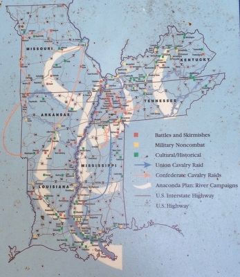
(Marker includes a map and 1862-1863 timeline)
Topics. This historical marker is listed in these topic lists: War, US Civil • Waterways & Vessels. A significant historical month for this entry is April 1862.
Location. 32° 48.422′ N, 91° 10.471′ W. Marker is in Lake Providence, Louisiana, in East Carroll Parish. Marker can be reached from the intersection of Lake Street (U.S. 65) and Ingram Street. Touch for map. Marker is at or near this postal address: 600 Lake Street, Lake Providence LA 71254, United States of America. Touch for directions.
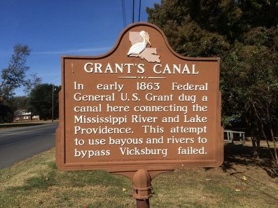
Other nearby markers. At least 8 other markers are within 3 miles of this marker, measured as the crow flies. Grant's March Through Louisiana (a few steps from this marker); Grant's Canal (within shouting distance of this marker); Soldiers' Rest (approx. half a mile away); Lake Providence Confederate Monument (approx. 0.6 miles away); Hood Home Plantation
(approx. 2.1 miles away); Gin Office (approx. 2.1 miles away); The Barn (approx. 2.2 miles away); Farming By Hand (approx. 2.2 miles away). Touch for a list and map of all markers in Lake Providence.
Also see . . . Wikipedia article on the Vicksburg Campaign. (Submitted on November 8, 2015, by Mark Hilton of Montgomery, Alabama.)
Credits. This page was last revised on June 16, 2016. It was originally submitted on November 8, 2015, by Mark Hilton of Montgomery, Alabama. This page has been viewed 686 times since then and 41 times this year. Photos: 1, 2, 3, 4, 5, 6, 7. submitted on November 8, 2015, by Mark Hilton of Montgomery, Alabama.
