Marker Logo HMdb.org THE HISTORICAL
MARKER DATABASE
“Bite-Size Bits of Local, National, and Global History”
Near Yards in Mercer County, West Virginia — The American South (Appalachia)
 

West Virginia (Mercer County) / Mercer County


West Virginia / Mercer County Marker image. Click for full size.
Photographed By J. J. Prats, October 16, 2015
1. West Virginia / Mercer County Marker
Inscription.
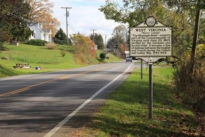
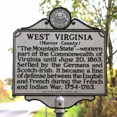
West Virginia (Mercer County)
"The Mountain State"—western part of the Commonwealth of Virginia until June 20, 1863. Settled by the Germans and Scotch-Irish. It became a line of defense between the English and French during the French and Indian War, 1754-1763.

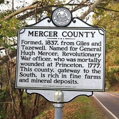
Mercer County
Formed, 1837, from Giles and Tazewell. Named for General Hugh Mercer, officer, who was mortally wounded at Princeton, 1777. This county, gateway to the South, is rich in fine farms and mineral deposits.
 
Erected 2012 by West Virginia Archives and History.
 
Topics and series. This historical marker is listed in these topic lists: Colonial EraPolitical SubdivisionsSettlements & SettlersWar, French and IndianWar, US Revolutionary. In addition, it is included in the West Virginia Archives and History series list. A significant historical year for this entry is 1837.
 
Location. 37° 17.571′ N, 81° 18.504′ W. Marker is near Yards, West Virginia, in Mercer County. Marker is on Falls Mills Road (West Virginia Route 102). It is just north of the state line. Touch for map. Marker is in this post office area: Nemours WV 24738, United States of America. Touch for directions.
 
Other nearby markers. At least 8 other markers are within 3 miles of this marker, measured
Paid Advertisement
Click on the ad for more information.
Please report objectionable advertising to the Editor.
Click or scan to see
this page online
as the crow flies. Engagement at Falls Mills (approx. 1.2 miles away in Virginia); Abb’s Valley (approx. 1.9 miles away in Virginia); Pocahontas (approx. 1.9 miles away in Virginia); Pocahontas Cemetery (approx. 1.9 miles away in Virginia); Jordan Nelson’s Coal Bank (approx. 1.9 miles away); Town of Pocahontas Commercial District (approx. 1.9 miles away in Virginia); Pinnacle Rock (approx. 2.1 miles away); The Birth of Pinnacle Rock State Park (approx. 2.2 miles away).
 
West Virginia / Mercer County Marker image. Click for full size.
Photographed By J. J. Prats, October 16, 2015
2. West Virginia / Mercer County Marker
West Virginia / Mercer County Marker image. Click for full size.
Photographed By J. J. Prats, October 16, 2015
3. West Virginia / Mercer County Marker
West Virginia / Mercer County Marker image. Click for full size.
Photographed By J. J. Prats, October 16, 2015
4. West Virginia / Mercer County Marker
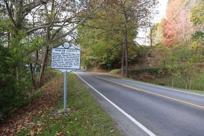
The photographer is facing Tazewell County, Virginia. The state line is about a tenth of a mile away.
 
 
Credits. This page was last revised on June 8, 2020. It was originally submitted on November 14, 2015, by J. J. Prats of Powell, Ohio. This page has been viewed 399 times since then and 20 times this year. Photos:   1, 2, 3, 4. submitted on November 14, 2015, by J. J. Prats of Powell, Ohio.
Share this page.  
Share on Tumblr
m=90595

CeraNet Cloud Computing sponsors the Historical Marker Database.
This website earns income from purchases you make after using our links to Amazon.com. We appreciate your support.
Paid Advertisement
Apr. 25, 2024