Marker Logo HMdb.org THE HISTORICAL
MARKER DATABASE
“Bite-Size Bits of Local, National, and Global History”
Pasadena in Anne Arundel County, Maryland — The American Northeast (Mid-Atlantic)
 

Hancock's Resolution

Built c. 1785


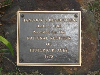
Hancock's Resolution Marker image. Click for full size.
Photographed By F. Robby, July 6, 2008
1. Hancock's Resolution Marker
Inscription.
Recorded on the
National Register
of
Historic Places

1975.

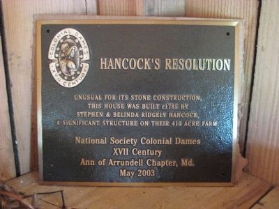
Second Marker (inside the facility):
Hancock's Resolution

Unusual for its stone construction, this house was built c1785 by Stephen & Belinda Ridgely Hancock, a significant structure on their 410 acre farm.
 
Erected 2003 by National Society Colonial Dames XVII Century, Ann of Arrundell Chapter, Md.
 
Topics and series. This historical marker is listed in these topic lists: AgricultureColonial EraSettlements & Settlers. In addition, it is included in the The Colonial Dames XVII Century, National Society series list. A significant historical year for this entry is 1975.
 
Location. 39° 8.112′ N, 76° 26.825′ W. Marker is in Pasadena, Maryland, in Anne Arundel County. Marker can be reached from Bayside Beach Road, 2.3 miles east of Fort Smallwood Road (Maryland Route 173). Marker is on a stone in the ground to the left of the house (to the right if looking at the house from Bayside Beach Road). Second marker (Colonial Dames) is located inside the Hancock's store building. Touch for map. Marker is in this post office area: Pasadena MD 21122, United States of America. Touch for directions.
 
Other nearby markers. At least 8 other markers are within 2 miles of this marker, measured as the crow flies. Captain John Smith (within shouting distance
Paid Advertisement
Click on the ad for more information.
Please report objectionable advertising to the Editor.
Click or scan to see
this page online
of this marker); Observing the Enemy (about 500 feet away, measured in a direct line); A Lighthouse Crumbles (approx. 1.7 miles away); The Tonkaway (approx. 1.7 miles away); Kids on the Farm (approx. 1.7 miles away); Improvements on the Bayfront (approx. 1.8 miles away); Veterans of Foreign Wars (approx. 1.8 miles away); Mother's Garden (approx. 1.9 miles away). Touch for a list and map of all markers in Pasadena.
 
Regarding Hancock's Resolution. The Hancock family was prosperous, but the home is of note because of its age and setting, and its lack of ever having had electricity or plumbing installed. Well into the 20th century the Hancock family resisted "modernizing" the home. The final owners - Mary and Henry Hancock (who were sister and brother, both without children) - lived in the home into the 1960s, and upon their death donated the home and surrounding property for public use. The house is now cared for and presented to the public on Sunday afternoons by the Friends of Hancock's Resolution (FOHR).
 
Also see . . .
Second Hancock's Resolution Marker image. Click for full size.
Photographed By F. Robby, July 6, 2008
2. Second Hancock's Resolution Marker
This marker is located within the store building adjacent to the main house.
 Official website of the Friends of Hancock's Resolution. (Submitted on July 26, 2008, by F. Robby of Baltimore, Maryland.)
 
Hancock's Resolution Marker image. Click for full size.
Photographed By F. Robby, July 6, 2008
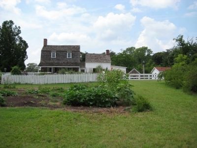
3. Hancock's Resolution Marker
Marker is at bottom in the foreground.
Hancock's Resolution image. Click for full size.
Photographed By F. Robby, July 6, 2008
4. Hancock's Resolution
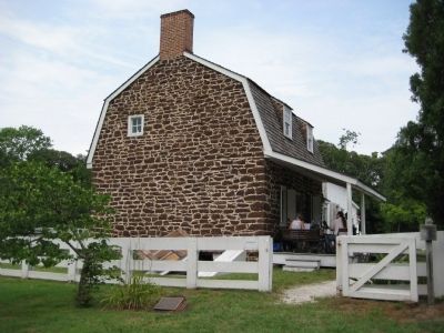
Front view (water-side) of Hancock's Resolution. The main house (largest part on left) is from c. 1785.
Hancock's Resolution image. Click for full size.
Photographed By F. Robby, July 6, 2008
5. Hancock's Resolution
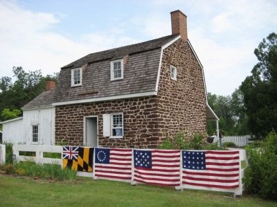
Rear view (Bayside Beach Road side) of Hancock's Resolution. Colonial and early American flags of Maryland and the United States are displayed on the fence.
Milk House image. Click for full size.
Photographed By F. Robby, July 6, 2008
6. Milk House
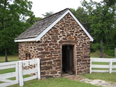
Stone milk house, also from c. 1785.
Hancock's Resolution image. Click for full size.
Photographed By F. Robby, July 6, 2008
7. Hancock's Resolution
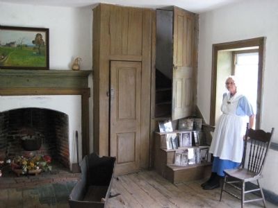
Interior of the stone house, with docent in period dress providing a tour of the building in grounds.
Hancock's Resolution Well image. Click for full size.
Photographed By F. Robby, July 6, 2008
8. Hancock's Resolution Well
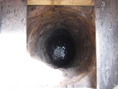
This well is believed to be the original from when the house was built. The only modifications made to it when restored were the top three feet.
Hancock's Resolution Cemetary image. Click for full size.
Photographed By F. Robby, July 6, 2008
9. Hancock's Resolution Cemetary
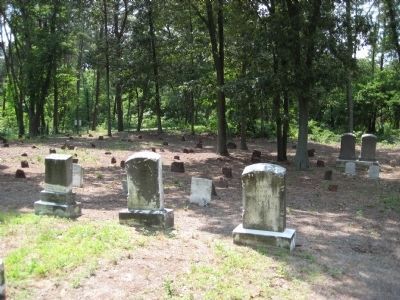
The two large stones in the middle of this photo mark the graves of the last two residents of Hancock's Resolution: Mary and Henry Hancock, who were sister and brother - neither married or had children.
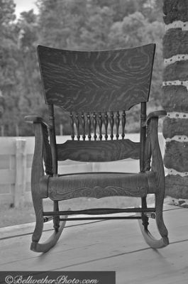
Rocking chair on the front porch image. Click for full size.
Photographed By Bellwether Photography, May 17, 2009
10. Rocking chair on the front porch
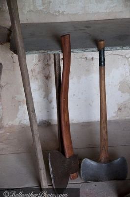
Tools In The Workshop image. Click for full size.
Photographed By Bellwether Photography, May 17, 2009
11. Tools In The Workshop
"Indian Moccasins" off the beaten path image. Click for full size.
Photographed By Bellwether Photography, May 17, 2009
12. "Indian Moccasins" off the beaten path
 
 
Credits. This page was last revised on August 5, 2021. It was originally submitted on July 11, 2008, by F. Robby of Baltimore, Maryland. This page has been viewed 2,910 times since then and 56 times this year. Photos:   1, 2, 3, 4, 5, 6, 7, 8, 9. submitted on July 11, 2008, by F. Robby of Baltimore, Maryland.   10, 11, 12. submitted on June 5, 2009, by Christopher Brown of Crofton, United States.
Share this page.  
Share on Tumblr
m=9064

CeraNet Cloud Computing sponsors the Historical Marker Database.
This website earns income from purchases you make after using our links to Amazon.com. We appreciate your support.
Paid Advertisement
Apr. 23, 2024