Lexington in Lafayette County, Missouri — The American Midwest (Upper Plains)
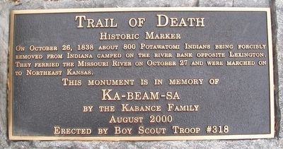
Trail of Death
Historical Marker
On October 26, 1838 about 800 Potawatomi Indians being forcibly removed from Indiana camped on the river bank opposite Lexington. They ferried the Missouri River on October 27 and were marched on to Northeast Kansas.
Ka-beam-sa
by the Kabance Family
August 2000
Erected 2000 by Boy Scout Troop #318.
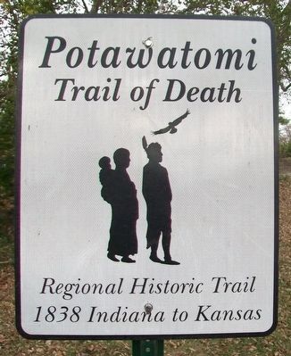
Topics and series. This historical marker is listed in these topic lists: Disasters • Native Americans • Settlements & Settlers • Waterways & Vessels. In addition, it is included in the Potawatomi Trail of Death series list. A significant historical month for this entry is August 2000.
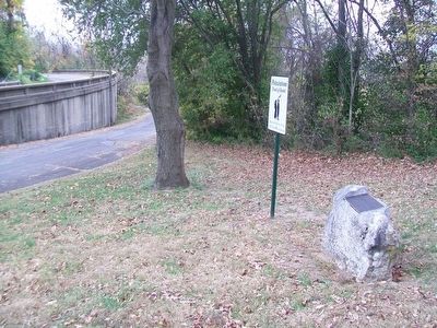
Location. 39° 11.2′ N, 93° 53.18′ W. Marker is in Lexington, Missouri, in Lafayette County. Marker is at the intersection of Broadway (Missouri Route 224) and Highland Avenue, on the right when traveling west on Broadway. Touch for map. Marker is in this post office area: Lexington MO 64067, United States of America. Touch for directions.
Other nearby markers. At least 8 other markers are within walking distance of this marker. Madonna of the Trail Monument (a few steps from this marker); Fifth Branch Bank Building (about 500 feet away, measured in a direct line); Alexander Mitchell & Company Bank (about 600 feet away); Original Site of Russell, Majors and Waddell Home Office (approx. 0.2 miles away); Replica of the Statue of Liberty (approx. 0.2 miles away); Wentworth World War Memorial (approx. 0.2 miles away); Lafayette County Courthouse (approx. 0.2 miles away); Lexington (approx. ¼ mile away). Touch for a list and map of all markers in Lexington.
Related marker. Click here for another marker that is related to this marker.
Also see . . .
1. Potawatomi Trail of Death Association. (Submitted on November 25, 2015, by William Fischer, Jr. of Scranton, Pennsylvania.)
2. Trail of Death (Citizen Potawatomi Nation). (Submitted on November 25, 2015, by William Fischer, Jr. of Scranton, Pennsylvania.)
3. Trail of Death Map. (Submitted on November 25, 2015, by William Fischer, Jr. of Scranton, Pennsylvania.)
Credits. This page was last revised on June 16, 2016. It was originally submitted on November 25, 2015, by William Fischer, Jr. of Scranton, Pennsylvania. This page has been viewed 402 times since then and 19 times this year. Photos: 1, 2, 3. submitted on November 25, 2015, by William Fischer, Jr. of Scranton, Pennsylvania.


