
Montgomery in Montgomery County, Alabama — The American South (East South Central)
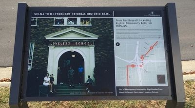
From Bus Boycott to Voting Rights: Community Activism 1955-65
West Jefferson Davis near Loveless School
| — | Selma to Montgomery National Historic Trail | — |
Photographed by Mark Hilton, December 11, 2015
1. From Bus Boycott to Voting Rights: Community Activism 1955-65 Marker
During the 13-month Montgomery Bus Boycott, community leaders encouraged Montgomery "everyday residents" to continue the long walks to work and home. The churches provided respite and support each week, reminding people that their suffering was for a higher cause.
Erected 2015 by the City of Montgomery. (Marker Number 4.)
Topics. This historical marker is listed in these topic lists: African Americans • Civil Rights • Industry & Commerce.
Location. 32° 21.966′ N, 86° 19.445′ W. Marker is in Montgomery, Alabama, in Montgomery County. It is at the intersection of West Jeff Davis Avenue and Bragg Street, on the right when traveling west on West Jeff Davis Avenue. Touch for map. Marker is
this page online

Regionally, this marker is in Alabama’s Tri-Counties River Region. It is also in the American South, specifically in the Deep South, and in the Black Belt. Globally, it is in North America, a Gulf of Mexico state, the Western Hemisphere, the Western World, and the Anglosphere. Historically, it finds itself in what was once the territory of the Mississippian Culture, one of the Confederate States of America, and the Antebellum South.
Other nearby markers. At least 8 other markers are within walking distance of this marker: Loveless School / Henry Allen Loveless (within shouting distance of this marker); Highway Construction Destroys Historic Black Neighborhoods (approx. 0.2 miles away); Percy Lavon Julian, PH.D. (approx. 0.2 miles away); Bethel Missionary Baptist Church (approx. 0.2 miles away); Holt Street Baptist Church (approx. ¼ mile away); Day Street Baptist Church (approx. ¼ mile away); Black Churches Provide Significant Support for the March and Voting (approx. ¼ mile away); Mount Zion African Methodist Episcopal AME Zion Church
Photographed by Mark Hilton, December 11, 2015
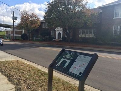
2. Loveless School in background.
Another marker is no longer nearby. Percy Lavon Julian (was approx. 0.2 miles away but has been confirmed missing).
Credits. This page was last revised on November 9, 2021. It was originally submitted on December 11, 2015, by Mark Hilton of Montgomery, Alabama. This page has been viewed 752 times since then and 15 times this year. Photos: 1, 2. submitted on December 11, 2015, by Mark Hilton of Montgomery, Alabama.
