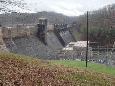
Dale Hollow Dam
On Obey River
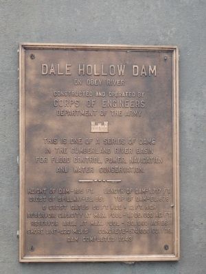
This is one of a series of dams in the Cumberland River Basin for flood control, power, navigation and water conservation.
Height of dam - 185 ft. Length of dam - 1,717 ft.
Crest of spillway - El. 651 Top of dam - El. 678
6 crest gates 60 ft. wide x 12 ft. high
Reservoir capacity at max pool - 1,706,000 Ac. Ft.
Reservoir area at max. pool - 30,990 acres
Shore line - 620 miles Concrete - 574,000 Cu. Yds.
Dam completed 1943
Topics. This historical marker is listed in these topic lists: Bridges & Viaducts • Environment • Man-Made Features. A significant historical year for this entry is 1943.
Location. 36° 32.297′ N, 85° 27.081′ W. Marker is near Celina, Tennessee, in Clay County. Marker is on Dale Hollow Dam Road. Touch for map. Marker is in this post office area: Celina TN 38551, United States of America. Touch for directions.
Other nearby markers. At least 8 other markers are within 4 miles of this marker, measured as the crow flies. Dale Hollow Dam / Dale Hollow Powerhouse (about 600 feet away, measured in a direct line); Free Hill(s) Community (approx. 1.3 miles away); Donaldson Cemetery (approx. 2.9 miles away); History of the Webb Cemetery (approx. 2.9 miles away); Hugh Roberts (approx. 3 miles away); William Hull Building
Credits. This page was last revised on June 16, 2016. It was originally submitted on December 22, 2015, by Chad Comer of Gamaliel, Kentucky. This page has been viewed 435 times since then and 12 times this year. Photos: 1, 2, 3. submitted on December 22, 2015, by Chad Comer of Gamaliel, Kentucky. • Bill Pfingsten was the editor who published this page.


