City Park in New Orleans in Orleans Parish, Louisiana — The American South (West South Central)
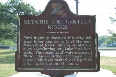
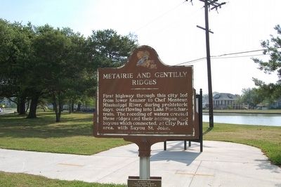
Metairie And Gentilly Ridges
(Plaque)
Dedicated by New Orleans Chapter, Louisiana Society D.A.R. March 22. 1964.
Erected 1964 by Department Of Commerce and Industry.
Topics and series. This historical marker is listed in these topic lists: Roads & Vehicles • Waterways & Vessels. In addition, it is included in the Daughters of the American Revolution series list.
Location. 29° 58.989′ N, 90° 5.462′ W. Marker is in New Orleans, Louisiana, in Orleans Parish. It is in City Park. Marker is at the intersection of Moss Street and North Carrollton Avenue, on the right when traveling east on Moss Street. Touch for map. Marker is in this post office area: New Orleans LA 70124, United States of America. Touch for directions.
Other nearby markers. At least 8 other markers are within walking distance of this marker. Allard Plantation (about 400 feet away, measured in a direct line); Pitot House (about 700 feet away); The Croatian Benevolent Association of Louisiana (approx. 0.2 miles away); In Memory of All American Veterans (approx. 0.2 miles away); Our Lady of the Rosary Rectory (approx. ¼ mile away); Duelling Grounds (approx. 0.3 miles away); The Old Portage (approx. 0.4 miles away); Beatles Only Concert Performance in Louisiana (approx. ¾ mile away). Touch for a list and map of all markers in New Orleans.
Credits. This page was last revised on February 12, 2023. It was originally submitted on January 3, 2016. This page has been viewed 489 times since then and 33 times this year. Photos: 1, 2. submitted on January 3, 2016. • Bernard Fisher was the editor who published this page.

