Marker Logo
THE HISTORICAL
MARKER DATABASE
“Bite-Size Bits of Local, National, and Global History”
Chimney Rock in Rutherford County, North Carolina — The American South (South Atlantic)
 

Barbara T. Meliski Park

A Gathering Place
 
 
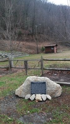
Barbara T. Meliski Park Marker image. Click for full size.
Photographed by Marsha A. Matson, December 25, 2015
1. Barbara T. Meliski Park Marker
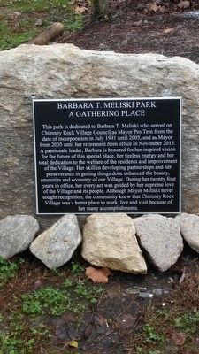
Inscription. This park is dedicated to Barbara T. Meliski who served on Chimney Rock Village Council as Mayor Pro Temp from the date of incorporation in July 1991 until 2005, and as Mayor from 2005 until her retirement from office in November 2015. A passionate leader, Barbara is honored for her inspired vision for the future of this special place, her tireless energy, and her total dedicated to the welfare of the residents and improvement of the Village. Her skill in developing partnerships and her perseverance in getting things done enhanced the beauty, amenities and economy of our Village. During her twenty-four years in office, her every act was guided by her supreme love of the Village and her people. Although Mayor Meliski never sought recognition, the community knew that Chimney Rock Village was a better place to work, live and visit because of her many accomplishments.
 
Topics. This historical marker is listed in these topic lists: Government & PoliticsParks & Recreational AreasWomen. A significant historical month for this entry is July 1991.
 
Location. 35° 26.357′ N, 82° 14.79′ W. Marker is in Chimney Rock, North Carolina, in Rutherford County. It can be reached from Main Street (Alternate U.S. 74). Touch for map. Marker is in this post office area: Chimney Rock NC 28720, United States of America. Touch for directions.

Regionally, this marker is in North Carolina’s Mountains. It is also in the American South, specifically in the Upper South, in Appalachia, and specifically in Southern Appalachia. Globally, it is in North America, the Western Hemisphere, the Western World, and the Anglosphere. Historically, it finds itself in what was once the territory of the Mississippian Culture, one of the original Thirteen Colonies, one of the Confederate States of America, and the Antebellum South.
Paid Advertisement
Click or scan to see
this page online


Other nearby markers. At least 8 other markers are within 6 miles of this marker, measured as the crow flies: Chimney Rock (about 600 feet away, measured in a direct line); Hickory Nut Gorge (approx. 0.3 miles away); In Commemoration (approx. half a mile away); The Legacy of Chimney Rock Park (approx. half a mile away); A Real Workhorse (approx. half a mile away); a different marker also named Chimney Rock (approx. 1.1 miles away); The 1927 Lake Lure Inn (approx. 1.1 miles away); Ayr (approx. 5.8 miles away). Touch for a list and map of all markers in Chimney Rock.
 
Barbara T. Meliski Park Marker image. Click for full size.
Photographed by Marsha A. Matson, December 25, 2015
2. Barbara T. Meliski Park Marker
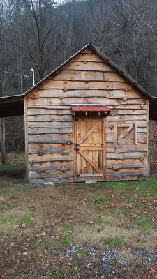
Nearby building image. Click for full size.
Photographed by Marsha A. Matson, December 25, 2015
3. Nearby building
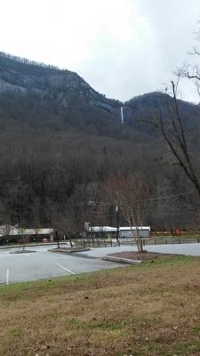
Surrounding scenery image. Click for full size.
Photographed by Marsha A. Matson, December 25, 2015
4. Surrounding scenery
 
 
Credits. This page was last revised on November 8, 2024. It was originally submitted on January 4, 2016, by Marsha A. Matson of Palmetto Bay, Florida. This page has been viewed 795 times since then and 21 times this year. Photos:   1, 2, 3, 4. submitted on January 4, 2016, by Marsha A. Matson of Palmetto Bay, Florida. • Bill Pfingsten was the editor who published this page.

m=92054

CeraNet Cloud Computing sponsors the Historical Marker Database.
This website earns income from purchases you make after using our links to Amazon.com. We appreciate your support.
Paid Advertisement
Aug. 16, 2026