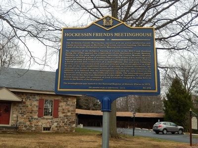
Hockessin Friends Meetinghouse
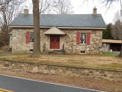
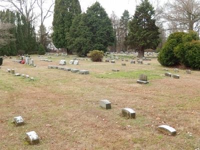
The expansion of the Religious Society of Friends in the Mill Creek Hundred during the 1730s spurred the organization of the Hockessin Friends Meeting. Members in this area who previously attended the Centre Monthly Meeting wanted to establish a place of worship closer to their homes. Early meetings were held in the home of William Cox until two tracts of land were acquired in 1737 for a burial ground and construction of a meetinghouse. The one-story fieldstone building was constructed in 1738 and later enlarged with a side addition in 1745. As one of the only established houses of worship in colonial Hockessin, the meetinghouse became the center of social and religious life in the community. In addition, it is believed that the meetinghouse operated the only school in the Hockessin area during the late 1700s and early 1800s. The meetinghouse played a brief role in the American Revolution on the night of September 9, 1777 when British troops under the command of Lord Cornwallis stopped to camp here enroute to the Battle of the Brandywine.
The meetinghouse was named to the National Register of Historic Places in
1973.Erected 2013 by Delaware Public Archives. (Marker Number NC-198.)
Topics and series. This historical marker is listed in these topic lists: Cemeteries & Burial Sites • Churches & Religion • Colonial Era • War, US Revolutionary. In addition, it is included in the Delaware Public Archives, and the Quakerism series lists. A significant historical year for this entry is 1738.
Location. 39° 47.56′ N, 75° 41.453′ W. Marker is in Hockessin, Delaware, in New Castle County. Marker is on Old Wilmington Road. Touch for map. Marker is at or near this postal address: 1501 Old Wilmington Road, Hockessin DE 19707, United States of America. Touch for directions.
Other nearby markers. At least 8 other markers are within one mile of this marker, measured as the crow flies. Cox-Phillips-Mitchell Agricultural Complex (approx. 0.3 miles away); St. John The Evangelist Church (approx. 0.4 miles away); Chippey African Union Methodist Church (approx. 0.7 miles away); Hockessin School #107C (approx. 0.7 miles away); First African-American Schoolhouse In Hockessin (approx. ¾ mile away); James Henry "Nip" Winters (approx. 0.9 miles away); Chair of Honor (approx. one mile away); Veterans Memorial (approx. one mile away). Touch for a list and map of all markers in Hockessin.
Credits. This page was last revised on June 16, 2016. It was originally submitted on January 9, 2016, by Bill Pfingsten of Bel Air, Maryland. This page has been viewed 519 times since then and 49 times this year. Photos: 1, 2, 3. submitted on January 9, 2016, by Bill Pfingsten of Bel Air, Maryland.


