Avon in Capitol Region, Connecticut — The American Northeast (New England)
The Farmington Canal in Avon
Photographed by Alan M. Perrie, November 3, 2013
1. The Farmington Canal in Avon Marker
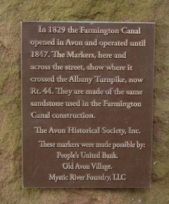
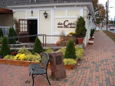
In 1829 the Farmington Canal opened in Avon and operated until 1847. The Markers, here and across the street, show where it crossed the Albany Turnpike, now Rt. 44. They are made of the same sandstone used in in the Farmington Canal construction.
Erected 2012.
Topics. This historical marker is listed in this topic list: Waterways & Vessels. A significant historical year for this entry is 1829.
Location. 41° 48.55′ N, 72° 49.8′ W. Marker is in Avon in Capitol Region, Connecticut. It is on Albany Turnpike (U.S. 44), on the right when traveling east. Touch for map. Marker is at or near this postal address: 5 East Main Street, Avon CT 06001, United States of America. Touch for directions.

Regionally, this marker is in the Connecticut River Valley, in Greater Hartford, and in the Knowledge Corridor. It is also in the American Northeast and in New England. Globally, it is in North America, the Western Hemisphere, the Western World, and the Anglosphere. Historically, it finds itself in what was once Hartford County and also one of the original Thirteen Colonies.
Other nearby markers. At least 8 other markers
this page online
Also see . . .
1. Farmington Canal. Wikipedia entry. (Submitted on September 26, 2020, by Larry Gertner of New York, New York.)
2. Farmington Canal State Park Trail maps. CT.gov entry. (Submitted on February 2, 2016, by Alan M. Perrie of Unionville, Connecticut.)
Additional commentary.
1. Canal Barge
Years ago I worked in a building on Rte 44 near the canal. I was told that the building had been the Avon Library in years past (pre-1990). Behind the library and a little to the west there was an old barge sitting unattended on a lot. It was said to have been used on the canal. Is this true? Is the barge
Photographed by Alan M. Perrie, November 3, 2013
2. Hungry for history
If you are hungry for Farmington Canal history, you have to come to Avon, CT. The Farmington Canal was placed on the National Register of Historic Places in 1985.
— Submitted March 31, 2017, by Mike Kelly of Tampa, Florida.
Photographed by Alan M. Perrie, November 3, 2013
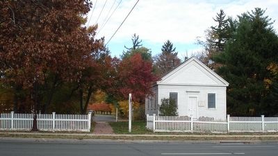
3. The Albany Turnpike went over the Farmington Canal.
The duplicate sandstone marker is across the Albany Turnpike to the left of the sidewalk. On the right is the Avon Historical Society.
Photographed by Alan M. Perrie, November 3, 2013
4. The Canal had a big role in Avon’s history.
In 1835, the 10 hour trip from Avon to New Haven cost $1.75.
Photographed by Alan M. Perrie, January 11, 2016
5. Avon’s Farmington Canal Trail
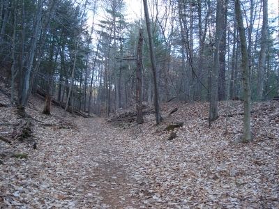
This trail in Avon could be the best in Connecticut for experiencing the size of the Farmington Canal. Most trails follow the towpath next to the canal, so you see the canal, but from the viewpoint of the tow animal. This trail, which has been cleared of trees, puts you in the canal. Walking in the middle of the canal you can experience it’s size. The canal was built wide enough for 2 boats to pass each other. When you walk at 4 mph, you will be traveling at the speed of a canal boat.
Photographed by Alan M. Perrie, January 11, 2016
6. Satellite map of Avon’s Farmington Canal Trail
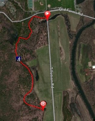
Park on the east side of Tillotson Road just before the stop sign at Old Farms Road. The yellow blazed trail starts on the west side, north of the bridge. At 0.4 miles, after going over the towpath, take a left into the almost 200 year old Farmington Canal. Take care crossing the Thomson Brook Culvert, since it is starting to show its age. Walk south for 0.8 miles in the middle of the Farmington Canal. Experience the size of the canal and note the very level towpath on your left (east). To the right is a large deposit of glacial till which was used to build the towpath. If you see the silo for the Sub Edge Farm, you need to turn around. The future plan is to continue the trail around Sub Edge Farm to join the Farmington Canal Trail in Farmington.
via NPS, unknown
7. The Farmington Canal
NPS photo series:
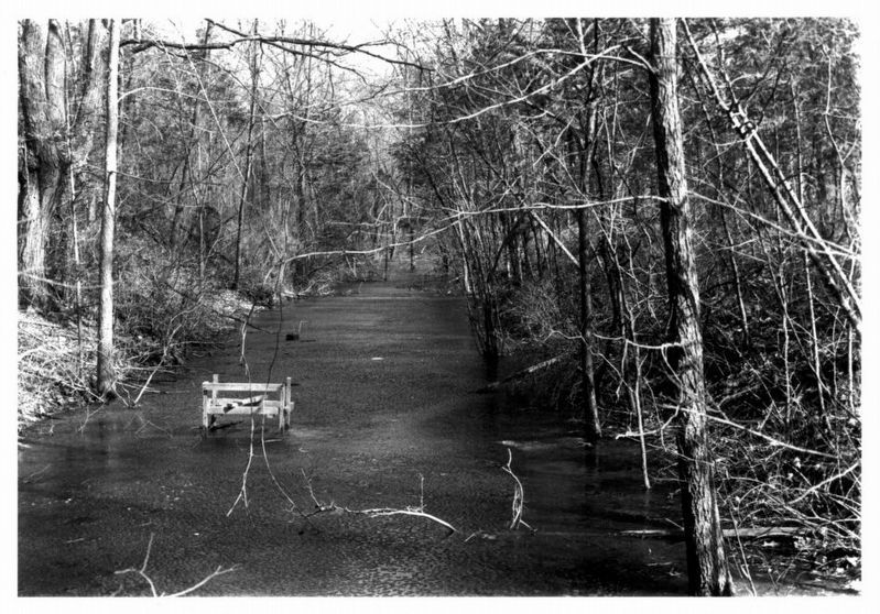
Photo #8 is of the Thompson Brook Culvert on the Canal Trail in Avon (1984)
Click for more information.
Photo #8 is of the Thompson Brook Culvert on the Canal Trail in Avon (1984)
Click for more information.
Credits. This page was last revised on May 19, 2026. It was originally submitted on February 2, 2016, by Alan M. Perrie of Unionville, Connecticut. This page has been viewed 1,364 times since then and 62 times this year. Photos: 1, 2, 3, 4, 5, 6. submitted on February 2, 2016, by Alan M. Perrie of Unionville, Connecticut. 7. submitted on December 4, 2022, by Larry Gertner of New York, New York. • Bill Pfingsten was the editor who published this page.
