Fairmeadow in Palo Alto in Santa Clara County, California — The American West (Pacific Coastal)
J. Pearce Mitchell Park
Inscription.
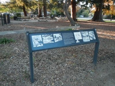
J. Pearce Mitchell Park, built in 1957, was one of the first of a new type of community park based on active recreation for leisure living. The design for this park and its playground served as important examples for many other parks and playgrounds in the United States and aboard during the decades to follow. The noteworthy plan of Mitchell Park came from landscape architect Robert Royston, whose innovative design solutions have given the park its special character.
The park is named after J. Pearce Mitchell (1880-1973), a longtime City Council member, Mayor, Stanford University Registrar and chemistry professor.
By 1998, many elements in the park, particularly the "tot play area," required renovation. The Palo Alto City Council recognized the importance of Mitchell Park as a community resource and funded three phases of park renovation between 2000 and 2007.
Erected by City of Palo Alto.
Topics. This historical marker is listed in these topic lists: Architecture • Education • Parks & Recreational Areas • Science & Medicine.
Location. 37° 25.377′ N, 122° 6.99′ W. Marker is in Palo Alto, California, in Santa Clara County. It is in Fairmeadow. Marker can be reached from East Meadow Drive near Middlefield Road, on the right when traveling east. Touch for map. Marker is at or near this postal address: 638 East Meadow Drive, Palo Alto CA 94306, United States of America. Touch for directions.
Other nearby markers. At least 8 other markers are within 2 miles of this marker, measured as the crow flies. El Palo Nuevo (approx. 0.2 miles away); Semiconductor Planar Process and Integrated Circuit (approx. ¾ mile away); First Commercially Practicable Integrated Circuit (approx. ¾ mile away); Homesite of Sarah Wallis (approx. 0.9 miles away); Juana Briones Park (approx. 1.2 miles away); Mayfield Fire Bell (approx. 1.2 miles away); Juana Briones. This is her park. (approx. 1.2 miles away); Birthplace of Silicon Valley (approx. 1.3 miles away). Touch for a list and map of all markers in Palo Alto.
More about this marker. This marker is located at the north end of J. Pearce Mitchell Park.
Credits. This page was last revised on February 7, 2023. It was originally submitted on February 4, 2016, by Barry Swackhamer of Brentwood, California. This page has been viewed 493 times since then and 24 times this year. Photos: 1, 2. submitted on February 4, 2016, by Barry Swackhamer of Brentwood, California.

