
Ridgeway in Orleans County, New York — The American Northeast (Mid-Atlantic)
Ridgeway - 1812
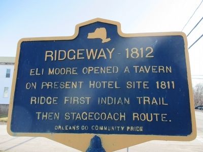
Photographed by Anton Schwarzmueller, February 7, 2016
1. Ridgeway - 1812 Marker
Erected by Orleans County Community Pride.
Topics. This historical marker is listed in these topic lists: Indigenous Peoples and Communities • Roads & Vehicles • Settlements & Settlers. A significant historical year for this entry is 1812.
Location. 43° 16.04′ N, 78° 23.591′ W. Marker is in Ridgeway, New York, in Orleans County. It is at the intersection of Ridge Road (New York State Route 104) and Angling Road, on the right when traveling west on Ridge Road. Marker is at a Sunoco gas station. The southward road at the intersection is N. Gravel Rd, NY route 63. Touch for map. Marker is at or near this postal address: 11279 Ridge Road, Medina NY 14103, United States of America. Touch for directions.

Regionally, this marker is in Upstate New York, specifically in Western New York, in the Finger Lakes, and in the Rochester Metropolitan Area. It is also in the American Northeast and in the Mid-Atlantic. Globally, it is in North America, on the Great Lakes, in the Western Hemisphere, in the Western World,
this page online
Other nearby markers. At least 8 other markers are within 3 miles of this marker, measured as the crow flies: Historic Ridge Road (approx. 1.7 miles away); Killed in Action - Vietnam (approx. 1.9 miles away); Boxwood Cemetery (approx. 2.4 miles away); Gulf Street Park (approx. 2.7 miles away); Anthony C. Biernacki (approx. 2.7 miles away); John Ryan 1801-96 / Medina Sandstone (approx. 2.9 miles away); "The Big Apple" (approx. 3 miles away); Frances Folsom (approx. 3 miles away).
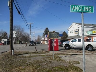
Photographed by Anton Schwarzmueller, February 7, 2016
2. Westward
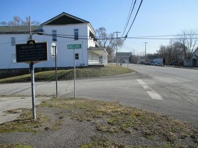
Photographed by Anton Schwarzmueller, February 7, 2016
3. Eastward
Credits. This page was last revised on December 8, 2020. It was originally submitted on February 7, 2016, by Anton Schwarzmueller of Wilson, New York. This page has been viewed 630 times since then and 16 times this year. Photos: 1, 2, 3. submitted on February 7, 2016, by Anton Schwarzmueller of Wilson, New York.
