Milford in Seward County, Nebraska — The American Midwest (Upper Plains)
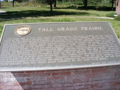
Tall Grass Prairie
Photographed by Don Morfe, September 11, 2007
1. Tall Grass Prairie Marker
this page online
Erected by Department of Roads-Nebraska State Historical Society. (Marker Number 179.)
Topics and series. This historical marker is listed in these topic lists: Horticulture & Forestry • Indigenous Peoples and Communities • Roads & Vehicles. In addition, it is included in the Nebraska State Historical Society series list. A significant historical year for this entry is 1865.
Location. 40° 49.277′ N, 97° 3.64′ W. Marker is in Milford, Nebraska, in Seward County. It is on I-80 Rest Stop. The rest stop is west of I-80 exit 382. Touch for map. Marker is in this post office area: Milford NE 68405, United States of America. Touch for directions.

Regionally, this marker is in Eastern Nebraska and in Greater Lincoln. It is also in the American Midwest, in the Corn Belt, and on the prairies. Globally, it is in North America, the Western Hemisphere, the Western World, and the Anglosphere. Historically, it finds itself in what was once the Louisiana Purchase.
Other nearby markers. At least 8 other markers are within 7 miles of this marker, measured as the crow flies: Purple Heart Trail (a few steps from this
Photographed by Don Morfe, September 11, 2007
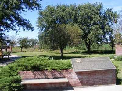
2. Tall Grass Prairie Marker
Credits. This page was last revised on June 16, 2016. It was originally submitted on February 10, 2016, by Don Morfe of Baltimore, Maryland. This page has been viewed 652 times since then and 33 times this year. Photos: 1, 2. submitted on February 10, 2016, by Don Morfe of Baltimore, Maryland. • Bill Pfingsten was the editor who published this page.
