Near Scotland in St. Mary's County, Maryland — The American Northeast (Mid-Atlantic)
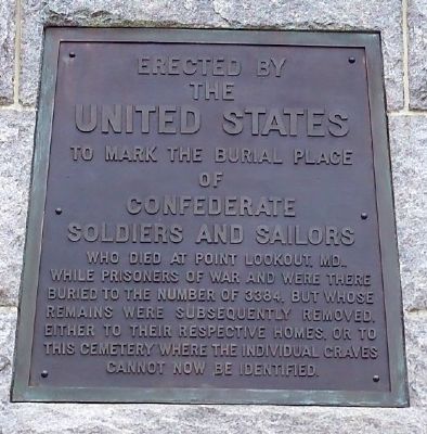
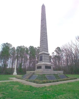
Point Lookout Confederate Cemetery
Erected 1911.
Topics and series. This historical marker is listed in these topic lists: Cemeteries & Burial Sites • War, US Civil. In addition, it is included in the National Cemeteries series list.
Location. 38° 4.406′ N, 76° 20.543′ W. Marker is near Scotland, Maryland, in St. Mary's County. Marker is at the intersection of Point Lookout Road (Maryland Route 5) and St. Michaels Manor Way, on the right when traveling south on Point Lookout Road. Touch for map. Marker is in this post office area: Scotland MD 20687, United States of America. Touch for directions.
Other nearby markers. At least 10 other markers are within 2 miles of this marker, measured as the crow flies. A different marker also named Point Lookout Confederate Cemetery (within shouting distance of this marker); a different marker also named Point Lookout Confederate Cemetery (within shouting distance of this marker); Point Lookout Prison Camp (about 400 feet away, measured in a direct line); Point Lookout Prison (about 500 feet away); Point Lookout Prisoner-of-War Camp (about 500 feet away); Maryland and the Confederacy (about 500 feet away); "The Bean Pot" (about 600 feet away); Storm Blocks the Route to Freedom (approx. 1.7 miles away); Point Lookout Prisoner-Of-War Camp (approx. 1.9 miles away); Prison Pen (approx. 2 miles away). Touch for a list and map of all markers in Scotland.
More about this marker. Brass tablets at the lower portion of the obelisk and on the base list the names of the dead.
Credits. This page was last revised on July 1, 2017. It was originally submitted on April 7, 2007, by Tom Fuchs of Greenbelt, Maryland. This page has been viewed 2,868 times since then and 44 times this year. Photos: 1, 2. submitted on April 7, 2007, by Tom Fuchs of Greenbelt, Maryland. • J. J. Prats was the editor who published this page.

