West Oakland in Alameda County, California — The American West (Pacific Coastal)
Seventh Street

Photographed By Barry Swackhamer, February 27, 2016
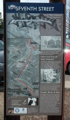
1. Seventh Street Marker
Captions: (top left) Map of the original bay shoreline.; (middle left) Aerial photograph showing the Key Route and Oakland Bay Trail.; (bottom left) Map orienting the above aerial photograph in relation to San Francisco Bay.; (middle right) Queen Anne cottages at the corner of Ninth Street and Mandela Parkway, West Oakland: typical working-class residences of the Victorian Period.; (bottom right) French and Italian Bakery, West Oakland, 1910.
The elevated BART tracks are the latest link in Seventh Street's long history as the transportation spine of West Oakland. The street once led to the long Wharf and Mole on the western waterfront where the Central/Southern Pacific maintained its transcontinental terminus. The ferry terminal served westbound passengers heading for San Francisco, and eastbound passengers boarding both local electric trams and steam trains for destinations across the country. The railroad's maintenance yards and shops covered hundreds of acres of reclaimed marsh south of Seventh Street. Industrial plants adjoined the overland tracks. This dynamic district supported West Oakland's richly diverse working-class culture.
West Oakland's neighborhoods in the late 19th and early 20th centuries included many families of African American, Latin American, Asian, and European origin. Among the largest immigrant communities were those from Italy, Greece, Portugal, and Mexico, each with its own network of churches, clubs and businesses. Seventh Street served as the commercial, social, and religious center for West Oakland's many ethnic groups, and the street abounded in Italian restaurants, Greek coffeehouses, Mexican grocery stores, and Black Churches.
West Oakland's African American community, one of California's largest, was a cradle for the emerging art forms of blues and jazz. Railroad employees brought back the latest recordings, and pioneer jazzmen like King Oliver and Kid Ory came to town in the 1920s. Seventh Street became a celebrated music venue known for small clubs like the Creole Café, Bluebird Cabaret and most famously, Slim Jenkins'. West Oakland was also home to well-known musicians such as the bandleader Sidney LeProtti and guitarist Saunders King, a minister's son raised in a Pentecostal church on Seventh Street. Gospel was represented by the flamboyant King Louis H. Narcisse, founder of Mount Zion Spiritual Temple Church, who made his first recordings in a Seventh Street studio.
Erected by San Francisco Bay Trail, Association of Bay Area Governments and Coastal Conservancy.
Topics. This historical marker is listed in these topic lists: Arts, Letters, Music • Entertainment • Roads & Vehicles • Waterways & Vessels.
Location. 37° 48.297′ N, 122° 17.625′ W. Marker is in Oakland, California, in Alameda County. It is in West Oakland. Marker is at the intersection of Mandela Parkway and 7th Street, on the right when traveling south on Mandela Parkway. Touch for map. Marker is at or near this postal address: 701 Mandela Parkway, Oakland CA 94607, United States of America. Touch for directions.
Other nearby markers. At least 8 other markers are within walking distance of this marker. The Music They Played on 7th Street (about 400 feet away, measured in a direct line); Liberty Hall (about 800 feet away); Dr. Huey P. Newton (approx. 0.2 miles away); Oakland Memorial Park (approx. 0.4 miles away); Food & Ships (approx. half a mile away); Ron Dellums (approx. half a mile away); West Oakland and Prescott (approx. half a mile away); Wild Oats Underdone Asparagas Boil (approx. half a mile away). Touch for a list and map of all markers in Oakland.
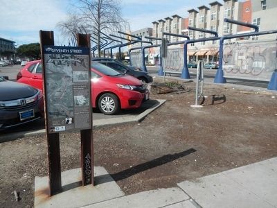
More about this marker. This marker is next to the BART parking lot.
Credits. This page was last revised on February 7, 2023. It was originally submitted on February 29, 2016, by Barry Swackhamer of Brentwood, California. This page has been viewed 569 times since then and 27 times this year. Photos: 1, 2. submitted on February 29, 2016, by Barry Swackhamer of Brentwood, California.
