Produce and Waterfront in Oakland in Alameda County, California — The American West (Pacific Coastal)
Estuary Industry

Photographed By Barry Swackhamer, February 28, 2016
1. Estuary Industry Marker
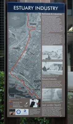
Captions: (top left) Map of the original bay shoreline.; (middle left) Aerial photograph showing the Key Route and Oakland Bay Trail.; (bottom left) Map orienting the above aerial photograph in relation to San Francisco Bay.; (upper right) Oakland Lumber Company, First & Broadway, 1894.; (middle right) Western Pacific passenger station, Third and Washington, soon after it opened in 1910.; (bottom right) This 1874 map shows a smokestack at the upper left next to water that fed the Oakland estuary.
Railroads and shipping set the stage for Oakland's industrial development. Transcontinental trains have been rumbling down the Embarcadero (old First Street) since 1869, and oceangoing vessels have been calling at local wharves since the 1870s, when channels began to be dredged. By bringing in raw materials and carrying away finished products, railroads and shipping lines served a wide variety of industries concentrated along the waterfront. The estuary shoreline bristled with wharves, coal bunkers, lumberyards, planing mills, foundries, factories. Oakland was a supply center for the region, storing huge reserves of coal and lumber.
Central Pacific and its successor, Southern Pacific, monopolized rail service and controlled the waterfront. In 1909, Western Pacific began service on a competing transcontinental line; the old passenger station still stands on Third and Washington Streets. Western Pacific triggered new lawsuits that allowed the city government (after decades of effort) to regain the shoreline from Southern Pacific and begin the task of creating a municipal port.
Industries found the estuary beneficial not only for transportation, but also for a bountiful supply of water, suitable for a wide variety of uses. Little thought was given, however, to cleaning the water after it was used. It would not be until the mid 20th century that waste water received some level of treatment.
The Port of Oakland began developing Jack London Square in the early 1950s at the foot of Broadway, as part of Oakland's centennial celebration. Since then, the complex of restaurants, retail stores, offices, hotels, and entertainment venues has grown to cover six blocks. It remains one of Oakland's premier destinations, drawing millions of visitors a year.
Erected by San Francisco Bay Trail, Association of Bay Area Governments and Coastal Conservancy.
Topics. This historical marker is listed in these topic lists: Industry & Commerce • Waterways & Vessels.
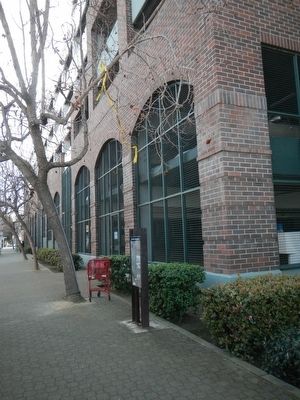
Location. 37° 47.816′ N, 122° 16.718′ W. Marker is in Oakland, California, in Alameda County. It is in Produce and Waterfront. Marker is at the intersection of 2nd Street and Clay Street, on the right when traveling south on 2nd Street. Touch for map. Marker is at or near this postal address: 501 2nd Street, Oakland CA 94607, United States of America. Touch for directions.
Other nearby markers. At least 8 other markers are within walking distance of this marker. The Port of Oakland (about 500 feet away, measured in a direct line); Western Pacific Railroad Depot (about 600 feet away); USS Potomac (about 600 feet away); History of the Transbay Ferry (about 700 feet away); Evolution of a Marine Terminal (about 800 feet away); Charles P. Howard Terminal (about 800 feet away); Birthplace of Oakland (approx. 0.2 miles away); Live Oak Lodge U.D (approx. 0.2 miles away). Touch for a list and map of all markers in Oakland.
Credits. This page was last revised on February 7, 2023. It was originally submitted on February 29, 2016, by Barry Swackhamer of Brentwood, California. This page has been viewed 372 times since then and 19 times this year. Photos: 1, 2. submitted on February 29, 2016, by Barry Swackhamer of Brentwood, California.
