Near Sebastian in Indian River County, Florida — The American South (South Atlantic)
Moore's Point
Photographed by Tim Fillmon, March 11, 2015
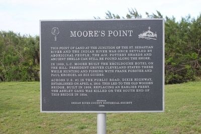
1. Moore's Point Marker
In 1889, L.C. Moore built the Ercildoune Hotel on the hill. President Grover Cleveland stayed there while hunting and fishing with Frank Forster and Paul Kroegel and his guides.
Across U.S. #1 is the public road, Dixie Highway, established on April 4, 1910. This led to the old wooden bridge, built in 1909, replacing an earlier ferry. The Ashley Gang was killed on the south end of this bridge in 1924.
Erected 1994 by Indian River County Historical Society.
Topics and series. This historical marker is listed in these topic lists: Indigenous Peoples and Communities • Industry & Commerce • Waterways & Vessels. In addition, it is included in the Former U.S. Presidents: #22 and #24 Grover Cleveland series list.
Location. 27° 51.026′ N, 80° 29.371′ W. Marker is near Sebastian, Florida, in Indian River County. It is at the intersection of U.S. 1 and North Indian
this page online

Regionally, this marker is in Florida’s Space Coast. It is also in the American South and on the Eastern Seaboard. Globally, it is in the North Atlantic Region, North America, a Gulf of Mexico state, the Western Hemisphere, the Western World, and the Anglosphere. Historically, it finds itself in what was once New Spain, the territory of the Mississippian Culture, one of the Confederate States of America, and the Antebellum South.
Other nearby markers. At least 8 other markers are within 3 miles of this marker, measured as the crow flies: Roseland (approx. 1.1 miles away); Park Family Cemetery (approx. 1.6 miles away); Sebastian Veterans Memorial (approx. 1.6 miles away); Sebastian Grammar School (approx. 2.4 miles away); Cannon (approx. 2½ miles away); Nuestra Senora de Atocha (approx. 2½ miles away); Iron Cannon (approx. 2½ miles away); 1715 "Spanish Plate Fleet" (approx. 2½ miles away). Touch for a list and map
Photographed by Tim Fillmon, March 11, 2015
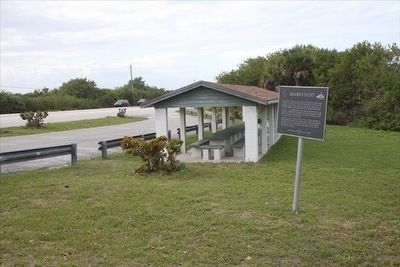
2. Moore's Point Marker in wayside park along US 1
Credits. This page was last revised on August 1, 2020. It was originally submitted on March 18, 2016, by Tim Fillmon of Webster, Florida. This page has been viewed 2,478 times since then and 137 times this year. Photos: 1, 2. submitted on March 18, 2016, by Tim Fillmon of Webster, Florida. • Bernard Fisher was the editor who published this page.
