Indian Green / McKinnis-Litzenberg Farmstead
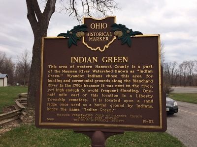
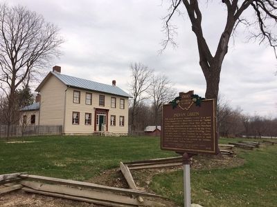
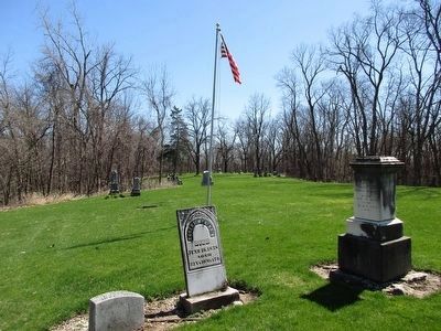
Indian Green. This area of western Hancock County is a part of the Maumee River Watershed known as "Indian Green." Wyandot Indians chose this area for hunting and ceremonial grounds along the Blanchard River in the 1700s because it was next to the river, yet high enough to avoid frequent flooding. One-half mile east of this location is a Liberty Township cemetery. It is located upon a sand ridge once used as a burial ground by Indians, hence the name "Indian Green."
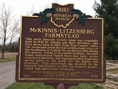
McKinnis-Litenberg Farmstead. This early Hancock County home was originally built in 1847 by Charles and Mary McKinnis, who first moved here in 1822 from Ross County, Ohio. The vernacular Greek Revival architectural style of the farmhouse is typical for northwest Ohio during this period. Owing to its remote location, the pine frame constructed English three-bay barn, reconstructed in the 1990s, and clapboard-sided farmhouse served many of the needs for the family and livestock. This farmstead was donated to the Hancock Park District in 1985 for historic preservation and educational purposes.
Erected 2009 by Historic Preservation Guild of Hancock County, Hancock Park District, and The Ohio Historical Society. (Marker Number 19-32.)
Topics and series. This historical marker is listed in these topic lists:
Location. 41° 3.561′ N, 83° 45.858′ W. Marker is near Findlay, Ohio, in Hancock County. Marker is on U.S. 224. Touch for map. Marker is in this post office area: Findlay OH 45840, United States of America. Touch for directions.
Other nearby markers. At least 8 other markers are within 4 miles of this marker, measured as the crow flies. In the fall of 1821 (within shouting distance of this marker); Barn Again! (about 300 feet away, measured in a direct line); Litzenberg Legacy (approx. 0.2 miles away); Indian Green Cemetery Veterans Memorial (approx. half a mile away); Schwartz Cemetery Veterans Memorial (approx. 1.4 miles away); McComb (approx. 3.1 miles away); The Village of McComb (approx. 3.4 miles away); St. John’s Evangelical Lutheran Church (approx. 3.6 miles away). Touch for a list and map of all markers in Findlay.
Credits. This page was last revised on May 23, 2022. It was originally submitted on March 28, 2016, by Michael Baker of Lima, Ohio. This page has been viewed 671 times since then and 65 times this year. Photos: 1, 2, 3. submitted on March 28, 2016, by Michael Baker of Lima, Ohio. 4. submitted on April 6, 2016, by Rev. Ronald Irick of West Liberty, Ohio. 5. submitted on January 28, 2021, by Craig Doda of Napoleon, Ohio. 6. submitted on May 16, 2022, by Craig Doda of Napoleon, Ohio. • Bill Pfingsten was the editor who published this page.
