Near Hilliard in Nassau County, Florida — The American South (South Atlantic)
Kings Ferry
Side 1
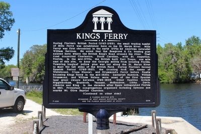
During Florida's British Period (1763-1783), the small trading hamlet of Mills Ferry was established here on the St. Marys River. Mills Ferry was first chronicled in the early 1770s by William Bartram. He noted that the Seagrove & Co. trading post existed here where the British King's Road crossed the river. That road connected Charleston, South Carolina, with St. Augustine, Florida. In the mid-1770s, the British built Fort Tonyn, one mile east of this site, to keep the Georgia militia from invading Florida. Towering longleaf yellow pine was cut along the St. Marys River to mast the tall ships of the British Navy. During Florida's Second Spanish Period (1783-1821), the crossing took the names of Whitehouse, (Casa Blanca), and Drummond's Ferry before finally becoming King's Ferry in the mid-1820s. Zachariah Haddock, William Drummond, and William Nelson were some of the first Spanish land grant owners between 1790-1805. Other families include Higginbotham, Braddock, Vanzant, McKendree, Libby, Davis, Albertie and King. In the decades after Spain relinquished Florida in 1821, Protestant congregations organized including Ephesus and nearby Mt. Olive Baptist Churches.
Side 2
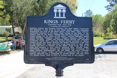
Brothers Gilbert and Franklin Germond and their father constructed and operated a mill here in the early 1850s. African-Americans constituted the bulk of the labor force. After 1865, many African-Americans remained in the area. They worked in the mills, in the forests, and on the docks, loading four and five-masted ships with lumber bound for all parts of the world. African-American family names included, Thompson, Taylor, Cooper, Timmons, Albertie, and Scipio. In 1870, William and Jackson Mizell arrived and expanded Germond's "Little Mill" into the largest milling operation in Nassau County. In the late 1870s, Hilliard and Bailey constructed a mill next to the Mizell mill. They also built a log tram south to what would become the Town of Hilliard. In the 1890s, Kings Ferry was at its peak and boasted a post office, millinery shop, Masonic Lodge, schoolhouse, churches, skating rink, blacksmith shop, newspaper, and many drinking establishments. By the 1920s, the town's economic activity had waned. Today, all signs of commercial life are gone, leaving memories and a scattering of private homes. The two-story T.W. Russell house, built in 1875, is located east of this marker.
Erected 2014 by West Nassau Historical Society and the Florida Department of State. (Marker Number F-820.)
Topics. This historical marker is listed in these topic lists: African Americans • Colonial Era • Settlements & Settlers • Waterways & Vessels.
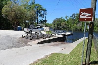
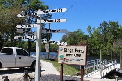
Location. 30° 47.18′ N, 81° 50.415′ W. Marker is near Hilliard, Florida, in Nassau County. Marker is on Bill Johnson Rd, 0.1 miles north of Kings Ferry Road (County Road 115A), on the left when traveling north. Marker is located at the Kings Ferry Boat Ramp on the St Marys River at the end of Bill Johnson Road. The river is the dividing line between Florida and Georgia. Touch for map. Marker is at or near this postal address: 49127 Bill Johnson Rd, Hilliard FL 32046, United States of America. Touch for directions.
Other nearby markers. At least 8 other markers are within 11 miles of this marker, measured as the crow flies. Treaty of Coleraine (approx. 5 miles away in Georgia); Tre Francesco Porfirio (approx. 8.9 miles away in Georgia); Jacob Joseph (approx. 9 miles away in Georgia); Joe H. Joseph / Hammond Roberts (approx. 9 miles away in Georgia); Post Road (approx. 10 miles away in Georgia); Henry Roddenberry (approx. 10.3 miles away in Georgia); Charlton County (approx. 10.3 miles away in Georgia); Central Dixie Highway (approx. 10.3 miles away in Georgia).
Credits. This page was last revised on February 10, 2018. It was originally submitted on April 12, 2016, by Tim Fillmon of Webster, Florida. This page has been viewed 1,853 times since then and 234 times this year. Photos: 1, 2, 3, 4. submitted on April 12, 2016, by Tim Fillmon of Webster, Florida. • Bill Pfingsten was the editor who published this page.


