Montgomery in Chatham County, Georgia — The American South (South Atlantic)
Site of Colonial Shipyard
Photographed by Mike Stroud, July 2008
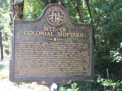
1. Site of Colonial Shipyard Marker
The creek on which it stood is known as Shipyard Creek. The site of the shipyard was on the Beaulieu (or Bewlie) plantation of John Morel and was favorable for shipbuilding activities because of its accessibility to the Vernon River and the plentiful supply of live oak in the vicinity.
Here, in December, 1774, Daniel Giroud, shipbuilder, constructed the brig "Bewlie," a vessel of 200 tons burden. In reporting the launching of the ship the "Georgia Gazette" stated that "those who are judges say she is well built and of the best materials, particularly her frame." During the American Revolution Giroud assisted in the construction of several Continental row galleys which saw service in Georgia waters.
Erected 1958 by Georgia Historical Commission. (Marker Number 025-66.)
Topics and series. This historical marker is listed in these topic lists: Colonial Era • Industry & Commerce • Settlements & Settlers • Waterways & Vessels.
this page online
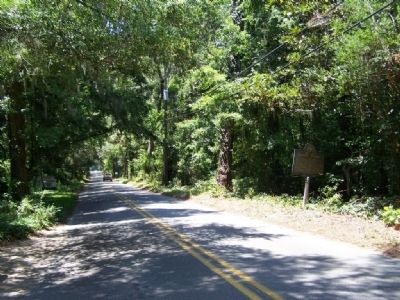
Location. 31° 56.548′ N, 81° 6.474′ W. Marker is in Montgomery, Georgia, in Chatham County. It is on Shipyard Road 0.2 miles east of Ferguson Road, on the right when traveling west. Touch for map. Marker is in this post office area: Savannah GA 31406, United States of America. Touch for directions.

Regionally, this marker is on the Coastal Plain, on the Georgia Coast and the Golden Isles, and in Greater Savannah. It is also in the American South, specifically in the Deep South, and on the Eastern Seaboard. Globally, it is in the North Atlantic Region, North America, the Western Hemisphere, the Western World, and the Anglosphere. Historically, it finds itself in what was once New Spain, the territory of the Mississippian Culture, one of the original Thirteen Colonies, one of the Confederate States of America, and the Antebellum South.
Other nearby markers. At least 8 other markers are within 3 miles of this marker, measured as the crow flies: Beaulieu Plantation (approx. 0.6 miles away); Pin Point Community
Photographed by Mike Stroud, 2008
2. Site of Colonial Shipyard Marker looking west on Shipyard Road
Credits. This page was last revised on November 24, 2019. It was originally submitted on July 21, 2008, by Mike Stroud of Bluffton, South Carolina. This page has been viewed 3,471 times since then and 70 times this year. Photos: 1, 2. submitted on July 21, 2008, by Mike Stroud of Bluffton, South Carolina. • Christopher Busta-Peck was the editor who published this page.
