East Dover Hundred in Kent County, Delaware — The American Northeast (Mid-Atlantic)
Eden Hill Farm
Photographed by Bill Pfingsten, April 29, 2016
1. Eden Hill Farm Marker
Inscription.
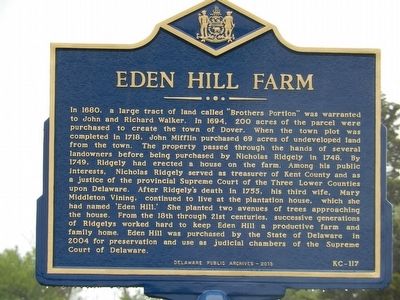
In 1680, a large tract of land called "Brothers Portion" was warranted to John and Richard Walker. In 1695, 200 acres of the parcel were purchased to create the town of Dover. When the town plot was completed in 1718, John Mifflin purchased 69 acres of undeveloped land from the town. The property passed througjh the hands of several landowners before being purchased by Nicholas Ridgely in 1748. By 1749, Ridgely had erected a house on the farm. Among his public interest, Nicholas Ridgely served as treasurer of Kent County and as a justice of the provincial Supreme Court of the Three Lower
Counties upon Delaware. After Ridgely's death in 1755, his third wife, Mary had named 'Eden Hill.' She planted two avenues of trees approaching the house. From the 18th through 21st centuries, successive generations of Ridgelys worked hard to keep Eden Hill a productive farm and family home. Eden Hill was purchased by the State of Delaware in 2004 for preservation and use as judicial chambers of the Supreme Court of Delaware.
Erected 2015 by Delaware Public Archives. (Marker Number KC-117.)
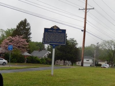
Location. 39° 9.207′ N, 75° 32.239′ W. Marker is in Dover, Delaware, in Kent County. It is in East Dover Hundred. It is at the intersection of West North Street and Dairy Barn Way on West North Street. Touch for map. Marker is in this post office area: Dover DE 19904, United States of America. Touch for directions.
Regionally, this marker is in the American Mid-Atlantic, on the Delmarva Peninsula, and on the Eastern Seaboard. Globally, it is in the North Atlantic Region, North America, the Western Hemisphere, the Western World, and the Anglosphere. Historically, it finds itself in what was once New Netherland, one of the original Thirteen Colonies, and the Antebellum South.
Credits. This page was last revised on May 15, 2026. It was originally submitted on May 2, 2016, by Bill Pfingsten of Bel Air, Maryland. This page has been viewed 1,190 times since then and 51 times this year. Photos:1, 2. submitted on May 2, 2016, by Bill Pfingsten of Bel Air, Maryland.