Lewiston in Niagara County, New York — The American Northeast (Mid-Atlantic)
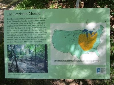
The Lewiston Mound
Hopewell influence spread from central and southern Ohio throughout the region shown in orange. The Hopewell trading network extended over even greater distances. Stars and cross hatching indicate the sources of trade materials. Map clarified by Arthur W. McGraw, 1995.
Topics. This historical marker is listed in this topic list: Native Americans. A significant historical year for this entry is 1995.
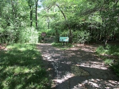
Location. 43° 9.992′ N, 79° 2.663′ W. Marker is in Lewiston, New York, in Niagara County. Marker can be reached from South 4th Street, 0.2 miles south of Tuscarora Street. Marker is on a trail in Artpark, a New York State park. The twin Oak Hill and Scovell Knoll markers are at both trail heads on South 4th Street. Touch for map. Marker is in this post office area: Lewiston NY 14092, United States of America. Touch for directions.
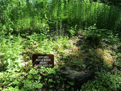
Other nearby markers. At least 8 other markers are within walking distance of this marker. A different marker also named Lewiston Mound (a few steps from this marker); Fort Joncaire (within shouting distance of this marker); The Magazin Royale (within shouting distance of this marker); The Cradles (within shouting distance of this marker); Oak Hill and Scovell Knoll (about 400 feet away, measured in a direct line); The Lower Landing (about 500 feet away); Welcome to Earl W. Brydges Artpark State Park (about 500 feet away); Lower Landing Archeological District (about 500 feet away). Touch for a list and map of all markers in Lewiston.
More about this marker. Except for the map caption, this marker has the same text as the Lewiston Mound marker, but does not replace the Lewiston Mound marker, which still stands.
Credits. This page was last revised on June 16, 2016. It was originally submitted on May 30, 2016, by Anton Schwarzmueller of Wilson, New York. This page has been viewed 832 times since then and 130 times this year. Photos: 1, 2, 3. submitted on May 30, 2016, by Anton Schwarzmueller of Wilson, New York.


