Emory Village in Atlanta in DeKalb County, Georgia — The American South (South Atlantic)
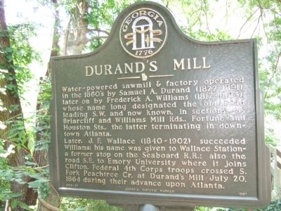
Durand's Mill
Later, J.F. Wallace (1840-1902) succeeded Williams; his name was given to Wallace Station-a former stop on the Seaboard R.R.; also the road S.E. to Emory University where it joins Clifton. Federal 4th Corps troops crossed S. Fork Peachtree Cr. at Durand’s Mill July 20, 1864 during their advance upon Atlanta.
Erected 1997 by Georgia Historic Marker. (Marker Number 044-27.)
Topics and series. This historical marker is listed in these topic lists: Industry & Commerce • War, US Civil. In addition, it is included in the Georgia Historical Society series list. A significant historical month for this entry is July 1879.
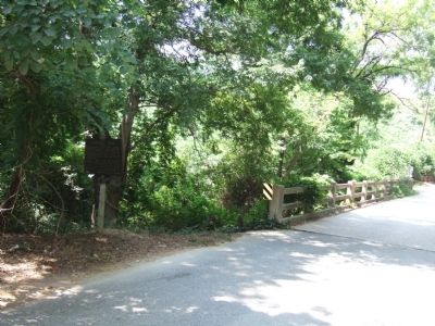
Location. 33° 48.201′ N, 84° 20.137′ W. Marker is in Atlanta, Georgia, in DeKalb County. It is in Emory Village. Marker is at the intersection of Old Briarcliff Road and Old Briarcliff Way, on the right when traveling north on Old Briarcliff Road. Touch for map. Marker is in this post office area: Atlanta GA 30306, United States of America. Touch for directions.
Other nearby markers. At least 8 other markers are within 2 miles of this marker, measured as the crow flies. 4th A.C. at Durand's Mill (approx. 0.4 miles away); Historic Ground (approx. half a mile away); Stanley & Wood March To Durand's Mill (approx. ¾ mile away); Stanley’s & Wood’s Sector (approx. 0.9 miles away); Closing the Gap (approx. 0.9 miles away); Between the Peachtree Cr. Forks (approx. 1.3 miles away); Site: Judge James Paden House: Gen. J.D. Cox’s H’dq’rs (approx. 1.3 miles away); The Hardman Family Cemetery (approx. 1.6 miles away). Touch for a list and map of all markers in Atlanta.
Credits. This page was last revised on February 8, 2023. It was originally submitted on July 24, 2008, by Felch Dumas of Decatur, Georgia. This page has been viewed 1,421 times since then and 27 times this year. Photos: 1, 2. submitted on July 24, 2008, by Felch Dumas of Decatur, Georgia. • Craig Swain was the editor who published this page.

