Williamsburg, Virginia — The American South (Mid-Atlantic)
Littletown
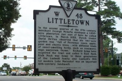
Photographed by Kathy Walker, August 11, 2007
1. Littletown Marker
Erected 1998 by Department of Historic Resources. (Marker Number W-48.)
Topics and series. This historical marker is listed in these topic lists: Agriculture • Colonial Era • Landmarks • Settlements & Settlers. In addition, it is included in the Virginia Department of Historic Resources (DHR) series list. A significant historical month for this entry is March 1633.
Location. 37° 15.29′ N, 76° 43.86′ W. Marker is in Williamsburg, Virginia. It is on Jamestown Road (Virginia Route 31) 0.1 miles north of Route 199, on the right when traveling north.
this page online

Regionally, this marker is on Virginia’s Peninsula, in Coastal Virginia, and in the Hampton Roads Metropolitan Area. It is also in the American South, specifically in the Upper South, in the Tidewater, and on the Eastern Seaboard. Globally, it is in the North Atlantic Region, North America, the Western Hemisphere, the Western World, and the Anglosphere. Historically, it finds itself in what was once the territory of the Mississippian Culture, one of the original Thirteen Colonies, one of the Confederate States of America, and the Antebellum South.
Other nearby markers. At least 8 other markers are within 2 miles of this marker, measured as the crow flies: Princess Anne Port (approx. 1.2 miles away); Williamsburg United Methodist Church (approx. 1.3 miles away); Methodism in Williamsburg (approx. 1.3 miles away); Our Confederate Dead (approx. 1.4 miles away); Great Neck (approx. 1.6 miles away); Mill Dam (approx. 1.6 miles away); College Camp (approx. 1.6 miles away); Arthur Azo Matsu
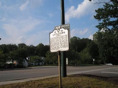
Photographed by Bill Coughlin, August 14, 2008
2. Littletown Marker
Credits. This page was last revised on March 2, 2021. It was originally submitted on July 24, 2008, by Kathy Walker of Stafford, Virginia. This page has been viewed 1,730 times since then and 60 times this year. Photos: 1. submitted on July 24, 2008, by Kathy Walker of Stafford, Virginia. 2. submitted on August 14, 2008, by Bill Coughlin of Woodland Park, New Jersey. • Christopher Busta-Peck was the editor who published this page.
