Unionville in Farmington in Hartford County, Connecticut — The American Northeast (New England)
An Industrial History of Unionville, 1780-1880
Inscription.
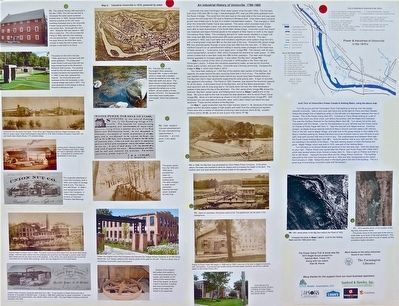
Unionville has used Farmington River water power since the late 1700s. The first dam (item D1 on map 1 and Photograph P1), built circa 1780, was just 200 yards upstream from the Route 4 bridge. The canal from this dam was on the west side of the river and was used to power the mill (map item 17), next to Riverfront Miniature Golf. Unionville’s early industrial growth was limited due to its lack of a modern transportation system. That changed in 1828 when the Unionville Feeder Canal was opened. This canal, which provided most of the water for the Farmington Canal, was also constructed as a transportation canal. Barges were able to dock downstream of the South Main Street bridge. Unionville could now import raw materials and export finished goods to the seaport at New Haven or north to the Upper Connecticut River Valley. The increasing demand for water power resulted in a larger crib dam <(map item D2) being constructed 300 yards upstream from the first. This dam, completed in 1832, was much taller and included a significant canal system (map item C1) with a holding basin (map item B1) for the east side of the river. Richard's Mill (photo image P2) now received power through a canal (map Item C2) from the new dam. In 1832, the Hartford Courant ran an advertisement selling or leasing
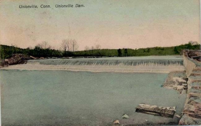
water privileges at the head-race of these canals at ..."a low price, if you act soon" (image P3). The railroad, with its year-round transportation, arrived in 1850, which increased the demand for water power. In 1856 James Cowles built a new dam (map item D3) further upstream. This dam went through several upgrades to increase capacity. It was called the “Big Dam” (image P4).
Map 2 is a photo of the View of Unionville in 1878 located in the Town Hall and Farmington Library. It shows the industries powered by water, as well as the churches, hotels, public school, and post office. Unionville was a thriving community. Compare this image to Map 1, which was made in 2015.
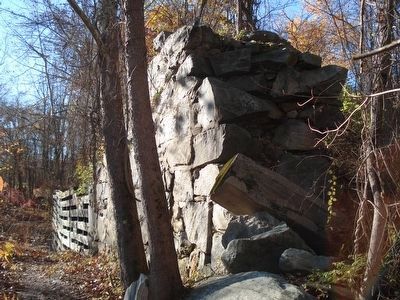
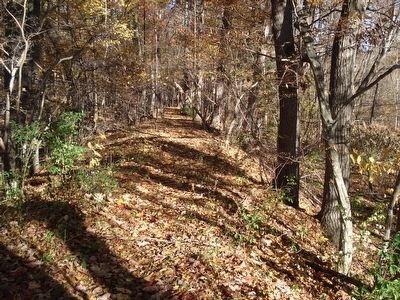
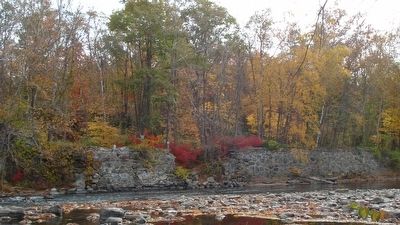
You have been walking on 1,000 feet of the earthen section of the Big Dam. At capacity, the water behind the dam would be three feet in front of you. The earthen dam was needed because the railroad tracks behind you would have been flooded without it. The Big Dam had two major abutments supporting the wide gravity dam. A layer of concrete was applied to the surface. The Flood of 1955, however, was beyond the structural capacity for all the dams. It eliminated much of the Big Dam, and all the dams downstream. The west abutment with its long wing wall is 100 yards down the trail; the 1955 flood waters peaked 5 feet above the top of the abutment. The 1951 aerial photo (image P6), shows the reservoir, Big Dam, power canal, and holding basin found on Maps1 and 2 prior to the flood. Be sure to walk to the river to find the east abutment, with its stone Power Canal (image P5). Much of it still remains as shown in the 2015 satellite photo (P7). With binoculars you can see slabs of concrete, rebar, and steel I-beam just below the east abutment. These are the remains of the Big Dam.
On Map 1, paper production was the major industry (items 1-4) because of the water power and abundant supply of soft water from the underground aquifers. There were also a variety of industries producing metal products (items 5-12), wooden furniture (items 14-16), as well as saw & grist mills (items 17-18).
Erected 2015 by Eagle Scout project for Satchel Moll, Troop 170.
Topics. This historical marker is listed in these topic lists: Education • Industry & Commerce • Man-Made Features • Waterways & Vessels. A significant historical year for this entry is 1780.
Location. 41° 46.348′ N, 72° 54.133′ W. Marker is in Farmington, Connecticut, in Hartford County. It is in Unionville. Marker can be reached from New Road (Connecticut Route 4). Touch for map. Marker is at or near this postal address: 755 New Rd, Avon CT 06001, United States of America. Touch for directions.
Other nearby markers. At least 8 other markers are within 2 miles of this marker, measured as the crow flies. Unionville Civil War Memorial (approx. 1.2 miles away); Unionville Veterans Monument (approx. 1.3 miles away); Unionville (approx. 1.3 miles away); Dawson Dawson-Watson (approx. 1.4 miles away); The Water Fountain (approx. 1.4 miles away); Suburban Park 1895-1905 (approx. 1.4 miles away); Yodkins-Morin Memorial (approx. 1.7 miles away); Yodkins-Morin Memorial Park (approx. 1.7 miles away). Touch for a list and map of all markers in Farmington.
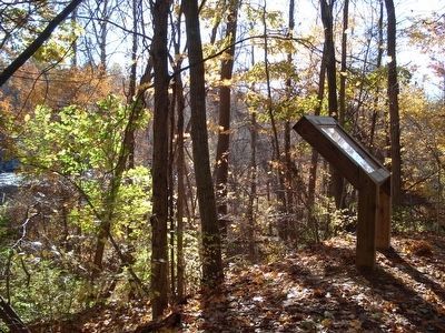
More about this marker. Marker is on the Power Dams Trail in Unionville, Connecticut (Hartford County). The trail begins at the Farmington River Trail parking lot on Route 4. The 2 mile level trail to the Marker requires directions from Farmington’s Recreation Department (see link below):
http://www.farmington-ct.org/home/showdocument?id=3575
Also see . . . Click here for additional historical information and pictures. (Submitted on November 4, 2015, by Alan M. Perrie of Unionville, Connecticut.)
Credits. This page was last revised on July 30, 2023. It was originally submitted on November 2, 2015, by Alan M. Perrie of Unionville, Connecticut. This page has been viewed 1,269 times since then and 60 times this year. Last updated on July 20, 2016, by Alan M. Perrie of Unionville, Connecticut. Photos: 1, 2, 3, 4, 5. submitted on November 2, 2015, by Alan M. Perrie of Unionville, Connecticut. 6. submitted on November 4, 2015. • Bill Pfingsten was the editor who published this page.
