Crowheart in Fremont County, Wyoming — The American West (Mountains)
The Riverton Project
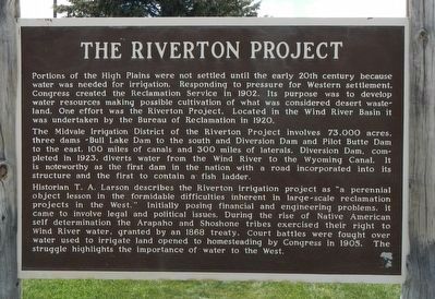
Photographed by Barry Swackhamer, May 30, 2016
1. The Riverton Project Marker
The Midvale Irrigation District of the Riverton Project involves 73,000 acres, three dams -- Bull Lake Dam to the south and Diversion Dam and Pilot Butte Dam to the east, 100 miles of canals and 300 miles of laterals. Diversion Dam, completed in 1923, diverts water from the Wind River to the Wyoming Canal. It is noteworthy as the first dam in the nation with a road incorporated into its structure and the first to contain a fish ladder.
Historian T.A. Larson describes the Riverton irrigation project as "a perennial object lesson in the formidable difficulties inherent in large-scale reclamation projects in the West." Initially posing financial and engineering problems, it
this page online
Erected by Wyoming State Parks and Historic Sites.
Topics. This historical marker is listed in these topic lists: Agriculture • Waterways & Vessels. A significant historical year for this entry is 1902.
Location. 43° 13.734′ N, 109° 0.516′ W. Marker is in Crowheart, Wyoming, in Fremont County. It is on U.S. 287 near U.S. 26, on the left when traveling west. Touch for map. Marker is at or near this postal address: 10014 U.S Highway 287, Kinnear WY 82516, United States of America. Touch for directions.

Regionally, this marker is on the Wind River Indian Reservation and in Wind River Country. It is also in the American Mountain West. Globally, it is in North America, the Rocky Mountains, the Western Hemisphere, the Western World, and the Anglosphere.
Other nearby markers. At
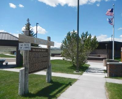
Photographed by Barry Swackhamer, May 30, 2016
2. The Riverton Project Marker
Another marker is no longer nearby. Crowheart Butte (was approx. 6.2 miles away but has been replaced with another marker now near it).
More about this marker. This marker is located at the Kinnear Rest Area.
Credits. This page was last revised on September 18, 2020. It was originally submitted on July 28, 2016, by Barry Swackhamer of Brentwood, California. This page has been viewed 655 times since then and 55 times this year. Photos: 1, 2. submitted on July 28, 2016, by Barry Swackhamer of Brentwood, California.
