Near Manteo in Dare County, North Carolina — The American South (South Atlantic)
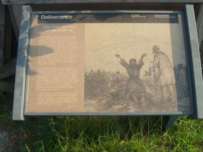
Deliverance
Fort Raleigh National Historic Site
| — | National Park Service, U.S. Department of the Interior | — |
Photographed by Kevin W., July 22, 2008
1. Deliverance Marker
Thus saith the Lord,
Let my people go.
Exodus 8:1
The bloodbath called the Civil War had begun and would cost the lives of over 600,000 Americans. As the Union armies advanced south, refugee slaves followed. After the Northern capture of Roanoke Island in February 1862, more than 3,000 ex-slaves arrived on the island. At the direction of Maj. Gen. John G. Foster, Army chaplain Horace James organized a formal colony with one-acre lots provided for about 600 families on the northern end of the island. Schools, mills, and houses were built.
At the war’s end almost 6,000 ex-slaves resided in Freedmen’s Town. These people tasted the sweet air of liberty for the first time on the north end of Roanoke Island. Marriages were legalized and equal rights and privileges were granted in courts of law. The promise seemed to be finally coming true for African-Americans and they discovered what all free people know. Freedom is never free!
With my hands against my breast I was going to my work when the overseer used to whip me along. Now, no more of that, no more of that. We’re free now; bless the Lord. They can’t sell my wife and child anymore, bless the Lord, no more of that, no more of that.
Click or scan to see
this page online
Erected by National Park Service, U.S. Department of the Interior.
Topics. This historical marker is listed in these topic lists: Abolition & Underground RR • African Americans • Settlements & Settlers • War, US Civil. A significant historical month for this entry is February 1862.
Location. Marker has been permanently removed. It was located near 35° 55.67′ N, 75° 43.418′ W. Marker was near Manteo, North Carolina, in Dare County. It was on Freedman's Colony Road near U.S. 64/264, on the right when traveling west. Marker was located at a pull-off on the right just before the William B. Umstead Memorial Bridge on the northern end of Roanoke Island. Touch for map. Marker was in this post office area: Manteo NC 27954, United States of America.
We have been informed that this marker is no longer there and will not be replaced. This page is an archival view of what was.
Regionally, this marker was in the Coastal Plain and on the Outer Banks. It was also in the American South, specifically in the Upper South, in the Tidewater, and on the Eastern Seaboard. Globally, it was in the North Atlantic

Photographed by Kevin W., July 22, 2008
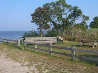
2. Deliverance (left) and Bondage (right) Markers
Other nearby markers. At least 8 other markers are within walking distance of this location: Naval Battle of Roanoke Island (within shouting distance of this marker); Fort Huger (about 300 feet away, measured in a direct line); Fort Blanchard (approx. 0.2 miles away); R. A. Fessenden (approx. 0.3 miles away); The Freedom Trail (approx. 0.9 miles away); Welcome to Fort Raleigh National Historic Site (approx. 0.9 miles away); First English Colonies (approx. one mile away); The Elizabethan Gardens (approx. one mile away). Touch for a list and map of all markers in Manteo.
Other markers no longer nearby. Bondage (was here, next to this marker but has been permanently removed); The Promised Land (was here, next to this marker but has been permanently removed).
More about this marker. The large picture of the marker is titled, The Sanctuary. It was drawn by Edwin Forbes in 1876. The caption also identifies the picture as Lithograph Plate No. 40. This same drawing appears on the nearby marker, First Light of Freedom.
Credits. This page was last revised on November 5, 2025. It was originally submitted on July 29, 2008, by Kevin W. of Stafford, Virginia. This page has been viewed 2,287 times since then and 38 times this year. Photos: 1, 2. submitted on July 29, 2008, by Kevin W. of Stafford, Virginia.
