Irwin in Westmoreland County, Pennsylvania — The American Northeast (Mid-Atlantic)
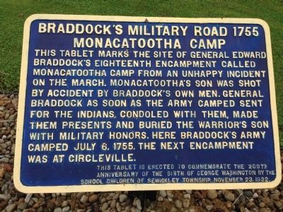
Braddock's Military Road 1755 Monacatootha's Camp
Inscription.
This tablet marks the site of General Edward Braddock’s eighteenth encampment called Monacatootha Camp from an unhappy incident on the march. Monacatooha’s son was shot by accident by Braddock’s own men. General Braddock as soon as the army camped sent for the Indians, condoled with them, made them presents and buried the warrior’s son with military honors. Here Braddock’s army camped July 6, 1755. The next encampment was at Circleville.
This tablet was erected to commemorate the 200th anniversary of the birth of George Washington by the school children of Sewickley Township November 23, 1932.
Erected 1932 by School Children of Sewickley Township.
Topics and series. This historical marker is listed in these topic lists: Cemeteries & Burial Sites • Native Americans • War, French and Indian. In addition, it is included in the Braddock’s Road and Maj. Gen. Edward Braddock series list. A significant historical date for this entry is July 6, 1755.
Location. 40° 17.249′ N, 79° 42.657′ W. Marker is in Irwin, Pennsylvania, in Westmoreland County. Marker is on Reservoir Road, 0.8 miles west of Clay Pike, on the left when traveling south. When heading south on Clay Pike from Irwin, make a left onto street called General Braddock Road also known as Howell Lane. Howell Lane turns into Reservoir Road. Touch for map. Marker is at or near this postal address: 348 Reservoir Rd, Irwin PA 15642, United States of America. Touch for directions.
Other nearby markers. At least 8 other markers are within 5 miles of this marker, measured as the crow flies. Fort Walthour (approx. 2.7 miles away); The Beginning of the Lincoln Highway (approx. 2.8 miles away); John Irwin House (approx. 2.8 miles away); Braddock's Military Road 1755 (approx. 3.1 miles away); Long Run Church (approx. 3.3 miles away); Lowber Honor Roll (approx. 4.3 miles away); Industry Roll of Honor (approx. 4.6 miles away); Arthur J. Rooney (approx. 4.7 miles away). Touch for a list and map of all markers in Irwin.
More about this marker. The marker is on private property but can easily be seen from the road. The homeowner set out small stone pavers to allow visitors to walk up to the marker.
Credits. This page was last revised on February 25, 2024. It was originally submitted on May 17, 2015, by Andrew Capets of Irwin, Pennsylvania. This page has been viewed 1,838 times since then and 66 times this year. Last updated on September 1, 2016, by Jay Stern of Connellsville, Pennsylvania. Photo 1. submitted on May 17, 2015, by Andrew Capets of Irwin, Pennsylvania. • Bill Pfingsten was the editor who published this page.
