Buffalo in Erie County, New York — The American Northeast (Mid-Atlantic)
Broderick Park / Distinctive River Ecosystems
National Underground Railroad Network to Freedom
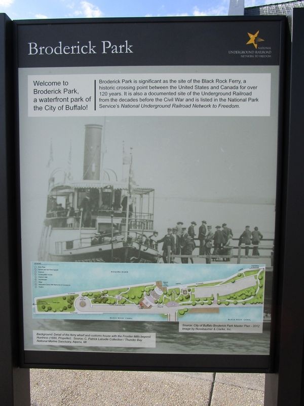
Welcome to Broderick Park, a waterfront park of the City of Buffalo!
Broderick Park is significant as the site of the Black Rock Ferry, a historic crossing point between the United States and Canada for over 120 years. It is also a documented site of the Underground Railroad from the decades before the Civil War and is listed in the National Park Service's National Underground Railroad Network to Freedom.
Background: Detail of the ferry wharf and customs house with the Frontier Mills beyond. Huntress (1880, Propeller). Source: C. Patrick Labadie Collection / Thunder Bay National Marine Sanctuary, Alpena, MI.
[right panel] Distinctive River Ecosystems.
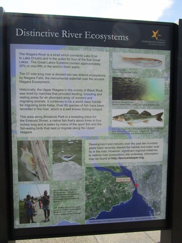
The Niagara River is a strait which connects Lake Erie to Lake Ontario and is the outlet for four of the five Great Lakes. the Great Lakes Systems contain approximately 20% or one-fifth of the world's fresh water.
The 37 mile-long river is divided into two distinct ecosystems by Niagara Falls, the monumental waterfall over the ancient Niagara Escarpment.
Historically, the Upper Niagara in the vicinity of Black Rock was lined by marshes that provided feeding, breeding and resting areas for an abundant array of resident and migrating animals. It continues to be a world class habitat for migrating birds today. Over 80 species of fish have been recorded in the river, which is a well known fishing hotspot.
This area along Broderick Park is a breeding place for the Emerald Shiner, a native fish that's about three to four inches long and is eaten by many of the sport fish and the fish-eating birds that nest or migrate along the Upper Niagara.
Emerald Shiner: Source: Photo by Nate Tessler.
School of Emerald Shiners. Source: Joshua Fisher, Great Lakes Center at Buffalo State [College].
Fish in the Niagara River at Broderick Park include: Smallmouth Bass, White Bass, Yellow Perch, Sheepshead, Smelt, Lake Trout, Steelhead Trout, and Walleye. Source: NPS.
Above: The Niagara River is designated as a Globally Significant Bird Area. Source: Buffalo Niagara Riverkeeper, photographer Jay Burney.
Left: Buffalo United Front hosts an Annual Family Fishing Day at Broderick Park - 2014. Source: Buffalo United Front, Inc.
Development and industry over the past two hundred years have severely altered the habitat and water quality in the river. However, significant regional initiatives to restore river ecosystems are underway. Information may be found at http://bnriverkeeper.org.
Erected 2016.
Topics and series. This historical marker is listed in these topic lists: Abolition & Underground RR • Environment. In addition, it is included in the National Underground Railroad Network to Freedom series list. A significant historical year for this entry is 2014.
Location. 42° 54.883′ N, 78° 54.167′ W. Marker is in Buffalo, New York, in Erie County. Marker is on Robert Rich Way, 0.1 miles south of Ferry Street Bridge, on the right when traveling south. Marker is in Broderick Park on the southern part of Unity Island, next to a service building. Access from Niagara Street (NY Route 266) is by the Ferry Street Bridge over the Black Rock Channel. Touch for map. Marker is in this post office area: Buffalo NY 14213, United States of America. Touch for directions.
Other nearby markers. At least 8 other markers are within walking distance of this marker. Black Rock Harbor / From Plantation to Promised Land (here, next to this marker); Harrowing Journey (a few steps from this marker); Underground Railroad River Crossing (within shouting distance of this marker); International Crossing (within shouting distance of this marker); Industrial Powerhouse (within shouting distance of this marker); West Ferry Street Bascule Bridge (within shouting distance of this marker); Lillion Batchelor - Champion of WNY History (about 300 feet away, measured in a direct line); Nowak Pier (about 600 feet away). Touch for a list and map of all markers in Buffalo.
Credits. This page was last revised on March 21, 2017. It was originally submitted on September 19, 2016, by Anton Schwarzmueller of Wilson, New York. This page has been viewed 399 times since then and 37 times this year. Photos: 1, 2, 3. submitted on September 19, 2016, by Anton Schwarzmueller of Wilson, New York.


