Riverdale Park in Prince George's County, Maryland — The American Northeast (Mid-Atlantic)
From Plantation to Suburb; a Community Grows
Town of Riverdale Park
Inscription.
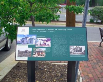
A key factor in the initial development
of Riverdale Park in 1887 was its proximity
to Washington, D.C. By the end of the
19th century, transportation between
Riverdale Park and Washington was
extremely convenient by either the
Baltimore Turnpike, the B & O Railroad,
or the trolley line. The town was one of
Maryland’s first manifestations of that
social phenomenon that in the 20th century
spawned the “suburb.”
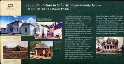
It was that same appealing location that provided the impetus for the building of Riversdale mansion there in 1801, one year after the federal city of Washington was established. Riversdale was the home of George Calvert, a descendant of the fifth Lord Baltimore and father of Charles Benedict, the founder of Maryland Agricultural College which later became the University of Maryland in nearby College Park. Today the mansion is a source of pride for residents of the town that now bears its name (albeit slightly modified). An annual celebration of the town’s heritage is held on the grounds of the mansion, now registered as a National Historic Landmark.
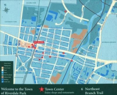
The town’s architecture is a mix of styles ranging from Victorian bungalows to cape cods to mid 20th-century ramblers. Its still convenient location and small-town culture explain Riverdale Park’s enduring popularity with old and new residents alike.
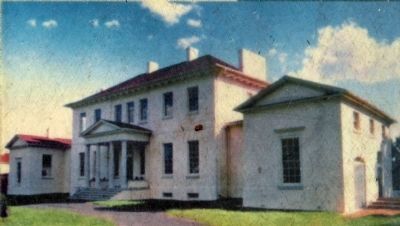
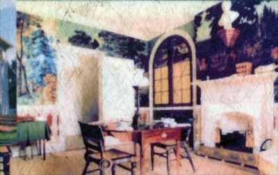
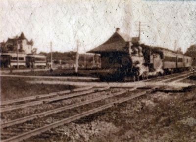
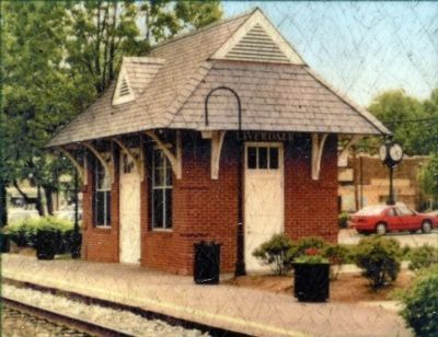
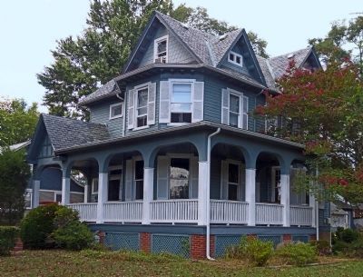
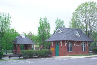
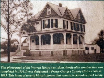
(captions) The Riversdale mansion, built between 1801 and 1807, underwent major renovation in the 1990s. • The french scenic wallpaper (1812–1814) in the dining room of Riversdale was preserved during the restoration efforts of the 1990s. • Today a reconstruction of the train station in the Town Center serves the MARC commuter train, which provides a 10-minute ride to Washington’s Union Station. • At the turn of the 20th century, a B&O train and a trolley line linked Riverdale Park to Washington, D.C. • This photograph of the Warren House was taken shortly after construction was completed in 1914. It was designated a Prince George’s County Historic Site in 1985. This is one of several historic homes that remain in Riverdale Park today.
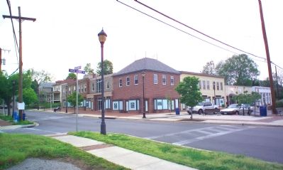
Photographed By Tom Fuchs, April 28, 2007
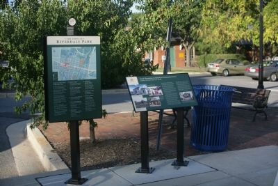
2. Corner of Queensbury Road and Rhode Island Avenue
The marker is across the intersection at the end of the crosswalk on the right. This view is northwest. The former WRECO station is behind the protographer and the MARC train station is out of frame to the right.
Erected 2007.
Topics and series. This historical marker is listed in these topic lists: Agriculture • Architecture • Education • Railroads & Streetcars • Roads & Vehicles • Settlements & Settlers. In addition, it is included in the Baltimore and Ohio Railroad (B&O) series list. A significant historical year for this entry is 1887.
Location. 38° 57.762′ N, 76° 56.128′ W. Marker is in Riverdale Park, Maryland, in Prince George's County. Marker is at the intersection of Queensbury Road and Rhode Island Avenue on Queensbury Road. Touch for map. Marker is at or near this postal address: 4650 Queensbury Rd, Riverdale MD 20737, United States of America. Touch for directions.
Other nearby markers. At least 10 other markers are within walking distance of this marker. The Town of Riverdale Park (here, next to this marker); Rhode Island Ave Trolley Trail (a few steps from this marker); This Clock (a few steps from this marker); Calvert Family Cemetery (about 300 feet away, measured in a direct line); Eternal Tribute
Photographed By Tom Fuchs, April 28, 2007
3. Replica of the B&O Riverdale Station
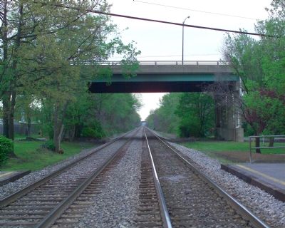
Washington's Union Station is 10 minutes away via MARC (Maryland Area Rail Commuter) trains. Riverdale is on MARC's Camden Line. This line is also known as the CSX Capitol Subdivision. The tracks from Baltimore run left to right between the two structures. Washington is to the right. This was originally the 1835 Washington Branch of the Baltimore and Ohio Railroad. The marker is at the edge of the parking lot out of frame on the right.
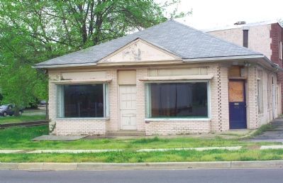
Regarding From Plantation to Suburb; a Community Grows. The trolley line mentioned was originally the City and Suburban Railway that reached Riverdale from Washington in 1899. The Berwyn and Laurel Electric Railroad Company built from Riverdale to Laurel, then merged with the City and Suburban. The line was absorbed by the Washington Railway & Electric Company (WRECO) and the former Riverdale trolley station, still standing at 4701 Queensbury Road, (see photo No. 4) is still known as the WRECO Station
Photographed By Tom Fuchs, April 28, 2007
4. The Former WRECO Trolley Station
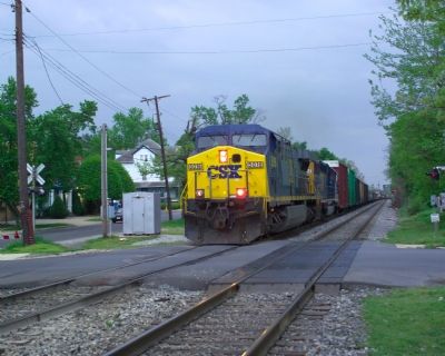
It was most recently the Riverdale Bookstore. The CSX railroad tracks pass on the left. The streetcar tracks ran on the right, on or next to Rhode Island Avenue. Queensbury Road is in the foreground. This view is from the marker.
Also see . . .
1. Impossible Challenge: The Baltimore and Ohio Railroad in Maryland. (Submitted on May 2, 2008, by Tom Fuchs of Greenbelt, Maryland.)
2. Impossible Challenge II: Baltimore to Washington and Harpers Ferry from 1828 to 1994. (Submitted on May 2, 2008, by Tom Fuchs of Greenbelt, Maryland.)
3. The Royal Blue Line. (Submitted on May 2, 2008, by Tom Fuchs of Greenbelt, Maryland.)
4. The Royal Blue Line: The Classic B&O Train Between Washington and New York. (Submitted on May 2, 2008, by Tom Fuchs of Greenbelt, Maryland.)
5. The Baltimore and Ohio Railroad (Railroad Color History). (Submitted on May 2, 2008, by Tom Fuchs of Greenbelt, Maryland.)
6. Baltimore and Ohio Railroad (MBI Railroad Color History). (Submitted on May 2, 2008, by Tom Fuchs of Greenbelt, Maryland.)
7. Baltimore and Ohio's Capitol Limited and National Limited (Great Passenger Trains). (Submitted on May 2, 2008, by Tom Fuchs of Greenbelt, Maryland.)
8. Route of the National Limited (Baltimore and Ohio Passenger Service, Volume 1). (Submitted on May 2, 2008, by Tom Fuchs of Greenbelt, Maryland.)
9. Route of the Capitol Limited (Baltimore and Ohio Passenger Service, Volume 2). (Submitted on May 2, 2008, by Tom Fuchs of Greenbelt, Maryland.)
10. The Great Road: The Building of the Baltimore and Ohio, the Nation's First Railroad 1828 - 1853. (Submitted on May 2, 2008, by Tom Fuchs of Greenbelt, Maryland.)
11. 100 Years of Capital Traction: The Story of Streetcars in the Nation's Capital. (Submitted on May 2, 2008, by Tom Fuchs of Greenbelt, Maryland.)
12. Capital Transit: Washington's Streetcars, The Final Era 1933 - 1962. (Submitted on May 2, 2008, by Tom Fuchs of Greenbelt, Maryland.)
Photographed By Tom Fuchs, April 28, 2007
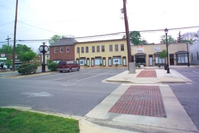
5. View From the Train Station
The former WRECO interurban trolley right-of-way is marked by the utility poles that cross the parking lot. The freshly painted storefronts of the Riverdale Park Town Center are all empty, except for the S&J Bar Restaurant on the far left.
Photographed By Tom Fuchs, April 28, 2007
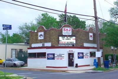
6. Crabs are Back!! at the S&J Bar Restaurant
So says the sign. It also says that the fish sandwich is $3.95, free Wi-Fi is available, and help is wanted. Karaoke with DJ Cowboy is every Tuesday and Saturday. This view is from the marker. The train station is behind the photographer and the former WRECO Station is just out-of-frame on the left.
Photographed By Allen C. Browne, August 24, 2013
15. Warren House
This photograph of the Warren House was taken shortly after construction was completed in 1914. It was designated a Prince Georges County Historic Site in 1985. This is one of several historic homes that remain in Riverdale today. Close-up of photo on marker
Credits. This page was last revised on March 21, 2020. It was originally submitted on May 2, 2007, by Tom Fuchs of Greenbelt, Maryland. This page has been viewed 2,487 times since then and 48 times this year. Photos: 1, 2, 3, 4, 5, 6, 7, 8. submitted on May 2, 2007, by Tom Fuchs of Greenbelt, Maryland. 9. submitted on September 17, 2007, by Tom Fuchs of Greenbelt, Maryland. 10, 11, 12, 13, 14, 15, 16, 17. submitted on August 26, 2013, by Allen C. Browne of Silver Spring, Maryland. • J. J. Prats was the editor who published this page.
