Stillwater in Saratoga County, New York — The American Northeast (Mid-Atlantic)
Bemis Heights
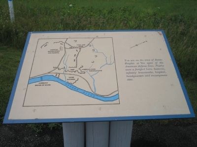
Photographed by Bill Coughlin, July 13, 2008
1. Bemis Heights Marker
Erected by Saratoga National Historic Park, National Park Service.
Topics. This historical marker is listed in these topic lists: Military • Notable Events • Notable Places • War, US Revolutionary.
Location. Marker has been permanently removed. It was located near 42° 59.192′ N, 73° 38.448′ W. Marker was in Stillwater, New York, in Saratoga County. It could be reached from Park Tour Road, on the left when traveling south. Marker is located in Saratoga National Historic Park along the auto tour road. Touch for map. Marker was in this post office area: Stillwater NY 12170, United States of America.
We have been informed that this marker is no longer there and will not be replaced. This page is an archival view of what was.
Regionally, this marker was in Upstate New York, in the Capital District, and in the Albany Metropolitan Area. It was also in the American

this page online
Other nearby markers. At least 8 other markers are within walking distance of this location: The Best Soldiers in America’s Northern Army (within shouting distance of this marker); First Allies of the United States (within shouting distance of this marker); Kosciuszko (about 300 feet away); Explore the American Defenses (about 300 feet away); Even a Friendly Army Does Damage (about 400 feet away); Camp Now or Never (about 400 feet away); A Struggle Never Forgotten (about 400 feet away); “you may well think that is hard living” (about 400 feet away). Touch for a list and map of all markers in Stillwater.
Other markers no longer nearby. The Neilson Farm (was about 300 feet away, measured in a direct line but has been permanently removed); Who Fought For The United States Here? (was about 400 feet away but has been permanently removed); John Neilson House and Farm
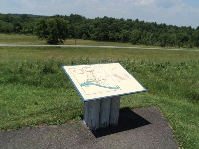
Photographed by Bill Coughlin, July 16, 2013
2. Bemis Heights Marker
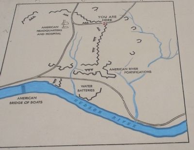
More about this marker. The left of the marker features a map of the American Encampment and forticifations on Bemis Heights in 1777.
Also see . . .
1. The Battle of Saratoga. Saratoga County Chamber of Commerce website entry (Submitted on March 29, 2022, by Larry Gertner of New York, New York.)
2. Saratoga National Historic Park. National Park Service. (Submitted on August 3, 2008, by Bill Coughlin of Woodland Park, New Jersey.)
3. A British perspective on the Battle of Saratoga from BritishBattles.com. (Submitted on July 18, 2013, by Bill Coughlin of Woodland Park, New Jersey.)
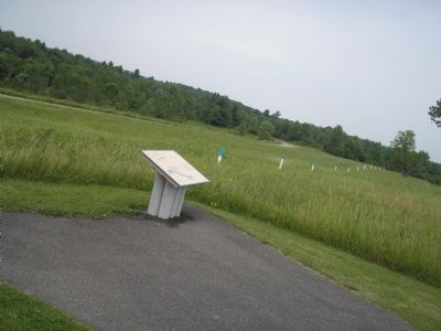
Photographed by Bill Coughlin, July 13, 2008
3. Marker in Saratoga National Historic Park
This was the location of John Neilson's farm before and after the Battles of Saratoga. The heights got their name from Jotham Bemis who had a tavern at the foot of the heights.
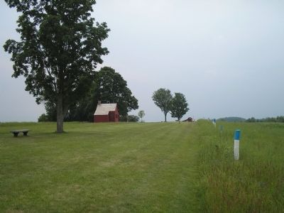
Photographed by Bill Coughlin, July 13, 2008
4. Neilson House
The house of John Neilson served as headquarters for American Generals Enoch Poor and Benedict Arnold. It is the only wartime structure remaining on the Saratoga battlefield. This photo was taken from the marker.
Photographed by Bill Coughlin, July 13, 2008
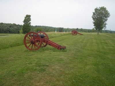
5. Artillery on Bemis Heights
The blue topped poles indicate the position of American fortifications during the 1777 Battles of Saratoga.
Photographed by Bill Coughlin, July 13, 2008
6. Bemis Heights Map
This map from the marker shows the postion of American fortifications on Bemis Heights in 1777. The site of the marker is also indicated on the map.
Credits. This page was last revised on July 30, 2024. It was originally submitted on August 3, 2008, by Bill Coughlin of Woodland Park, New Jersey. This page has been viewed 3,032 times since then and 129 times this year. Photos: 1. submitted on August 3, 2008, by Bill Coughlin of Woodland Park, New Jersey. 2. submitted on July 18, 2013, by Bill Coughlin of Woodland Park, New Jersey. 3, 4, 5, 6. submitted on August 3, 2008, by Bill Coughlin of Woodland Park, New Jersey.
