Flores, Petén, Guatemala — Central America
Tayasal Archaeological Site
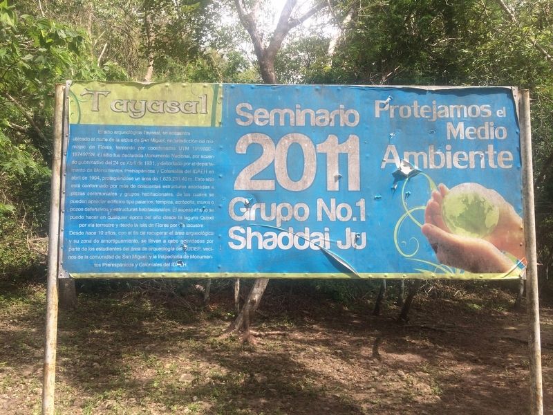
El sitio arqueológico Tayasal, se encuentra ubicado al norte de la aldea de San Miguel, en jurisdicción del municipio de Flores, teniendo por coordenadas UTM 191950 E – 1874975N. El sitio fue declarado Monumento Nacional, por acuerdo gubernativo del 24 de Abril de 1931, y delimitado por el departamento de Monumentos Prehispánicos y Coloniales del IDAEH en abril de 1994, protegiéndose un área de 1,629, 291.40 m. Este sitio está conformado por más de doscientas estructuras asociados a plazas ceremoniales y grupos habitacionales. El acceso al sitio se puede hacer en cualquier época del año desde la laguna Quexil por via terrestre y desde la isla de Flores por via lacustre. Desde hace 10 años, con el fin de recuperar el área arqueológica y su zona de amortiguamiento, se llevan a cabo activades por parte de los estudiantes del área de arqueología del CUDEP, vecinos de la comunidad de San Miguel y la Inspectoría de Monumentos Prehispánicos y Coloniales del IDAEH.
Seminario 2011 Grupo No. 1 Shaddai Ju
Protejamos el Medio Ambiente
The Tayasal archaeological site is located north of the village of San Miguel, in the municipality of Flores, with UTM coordinates of 191950E, 1874975N. The site was declared a National Monument through the government decree of April 24, 1931. Its boundaries were set by the Department of Colonial and Prehispanic Monuments of the Institute of Anthropology and History (Instituto de Antropología e Historia, IDAEH) in April 1994, protecting an area of 1,629, 291.40 m. This site is comprised of more than two hundred associated structures, including ceremonial plazas and residential groups. Access to the site can be made at any time of the year, by land via the road that crosses near Lake Quexil and by boat from the island of Flores. In the last 10 years, in order to recover the archaeological area and its buffer zone, work has been carried out by archeology students of the CUDEP University, residents of the community of San Miguel and workers of the Department of Colonial and Prehispanic Monuments of the IDAEH.
Seminar 2011, Group No. 1, Shaddai Ju
Let's Protect the Environment
Erected 2011.
Topics. This historical marker is listed in these topic lists: Anthropology & Archaeology • Man-Made Features • Native Americans. A significant historical date for this entry is April 24, 1931.
Location. 16° 56.271′ N, 89° 53.857′ W. Marker

Photographed By J. Makali Bruton, August 18, 2016
2. Tayasal Archaeological Site Marker
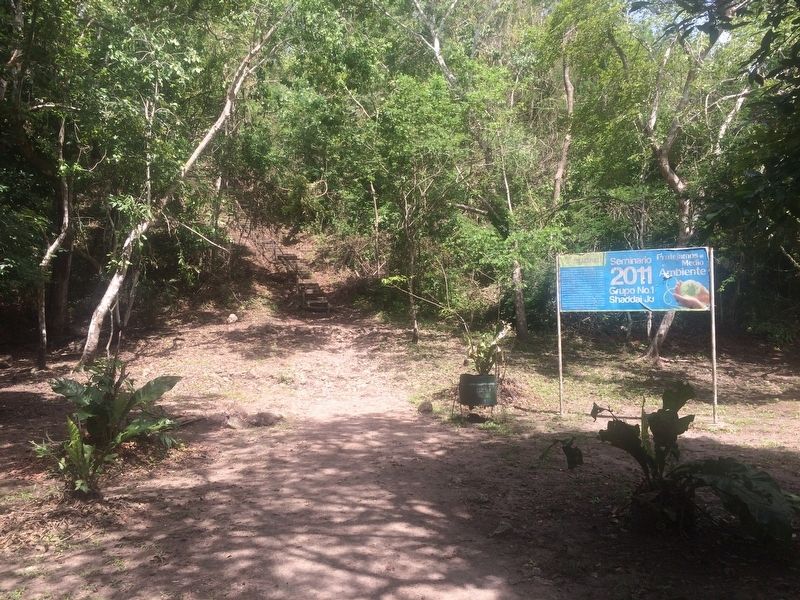
The stairs to the left of the marker lead to the top of the King Can'Ek Lookout (Mirador Rey Can'Ek). The lookout itself is part of a massive Mayan pyramid, although it is hard to see due to the amount of vegetation at the site.
Credits. This page was last revised on June 25, 2020. It was originally submitted on October 21, 2016, by J. Makali Bruton of Accra, Ghana. This page has been viewed 387 times since then and 18 times this year. Photos: 1, 2, 3. submitted on October 21, 2016, by J. Makali Bruton of Accra, Ghana.

