Melchor de Mencos, Petén, Guatemala — Central America
The Eastern Acropolis of Yaxhá
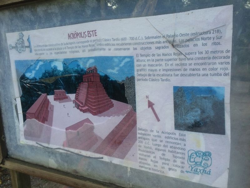
Acrópolis Este
La última etapa constructiva de la Acrópolis corresponde al periodo Clásico Tardío (600 – 700 d.C.). Sobresalen el Palacio Oeste (estructura 218), que sirvió de acceso a la plaza y el Templo de la Manos Rojas; ambos edificios recubrieron construcciones más antiguas. Los palacios Norte y Sur albergaron a los especialistas religiosos, allí probablemente se conservaron los objetos sagrados utilizados en los ritos.
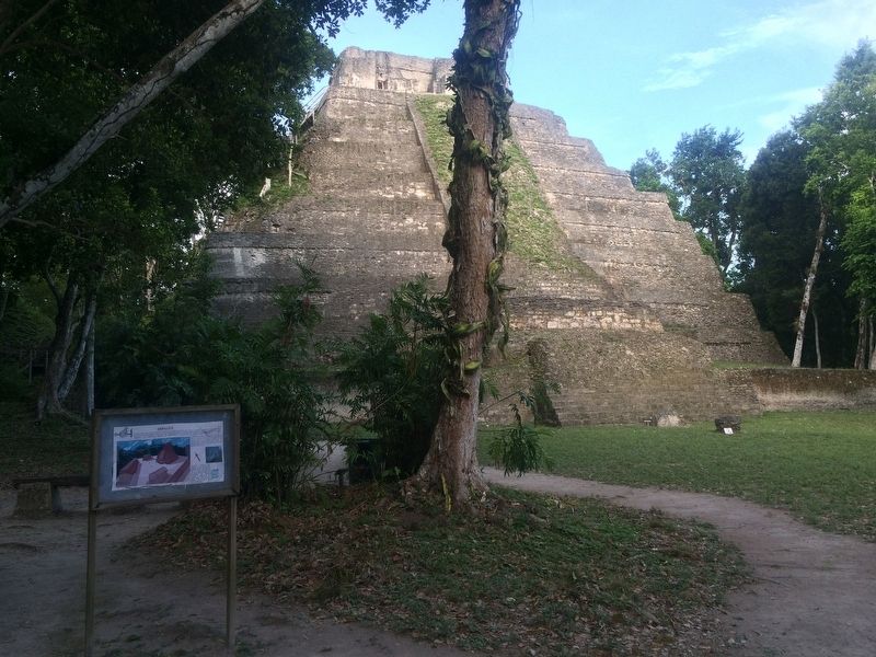
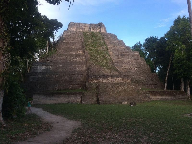
El Templo de las Manos Rojas supera los 30 metros de altura; en la parte superior tuvo una crestería decorada con un mascarón. En el recinto se encontraron varios graffiti mayas e impresiones de manos en color rojo. Debajo de la escalinata fue descubierta una tumba del período Clásico Tardío.
Debajo de la Acrópolis Este subyacen varios edificios más antiguos que se remontan a 200 d.C. Luego del abandono de Yaxhá, algunos habitantes Postclásicos de Topoxté visitaron el Templo de las Manos Rojas para colocar ofrendas en un gesto de memoria histórica.
The Eastern Acropolis
The last construction stage of the Acropolis corresponds to the Late Classic period (600-700 A.D.). A good example of the construction here is the Western Palace (structure 218), which served as an access to the square and the Temple of the Red Hand. Both of these buildings encompassed older constructions. The Northern and Southern palaces were the residences of religious specialists, where it is likely that sacred objects used in rituals were preserved.
The Temple of the Red Hands is over 30 meters high; at the top was a crest decorated with a figurehead. In the area were found several Mayan graffiti and drawings of red hands. Under the staircase a tomb from the Late Classic period was also discovered.
Underneath the Eastern Acropolis are several older buildings that date back to 200 A.D. After the abandonment of Yaxhá, some Postclassic inhabitants of Topoxté visited the Temple of the Red Hands to place offerings in a gesture of historical memory.
Topics. This historical marker is listed in these topic lists: Anthropology & Archaeology • Man-Made Features • Native Americans.
Location. 17° 4.312′ N, 89° 23.907′ W. Marker is in Melchor de Mencos, Petén. The marker is towards the northern part of the Eastern Acropolis at the Yaxhá Archaeological Park. The park is some 5 kilometers north of the village of El Zapote, turning from the CA13 road. Touch for map. Marker is in this post office area: Melchor de Mencos, Petén 17011, Guatemala. Touch for directions.
Other nearby markers. At least 8 other markers are within walking distance of this marker. Plaza of the Columns (about 90 meters away, measured in a direct line); Yaxhá (about 180 meters away); Minor Astronomical Complex at Yaxhá (about 180 meters away); The Quarry Causeway (about 210 meters away); East Causeway Residential Zone (about 240 meters away); Intersection of the Eastern and Quarry Causeways (approx. 0.4 kilometers away); Sacrificial Pyramid (approx. half a kilometer away); The Palace's Ballgame (approx. half a kilometer away). Touch for a list and map of all markers in Melchor de Mencos.
Credits. This page was last revised on March 2, 2018. It was originally submitted on October 25, 2016, by J. Makali Bruton of Accra, Ghana. This page has been viewed 406 times since then and 16 times this year. Photos: 1, 2, 3, 4. submitted on October 25, 2016, by J. Makali Bruton of Accra, Ghana.


