Melchor de Mencos, Petén, Guatemala — Central America
The North Acropolis at Yaxhá
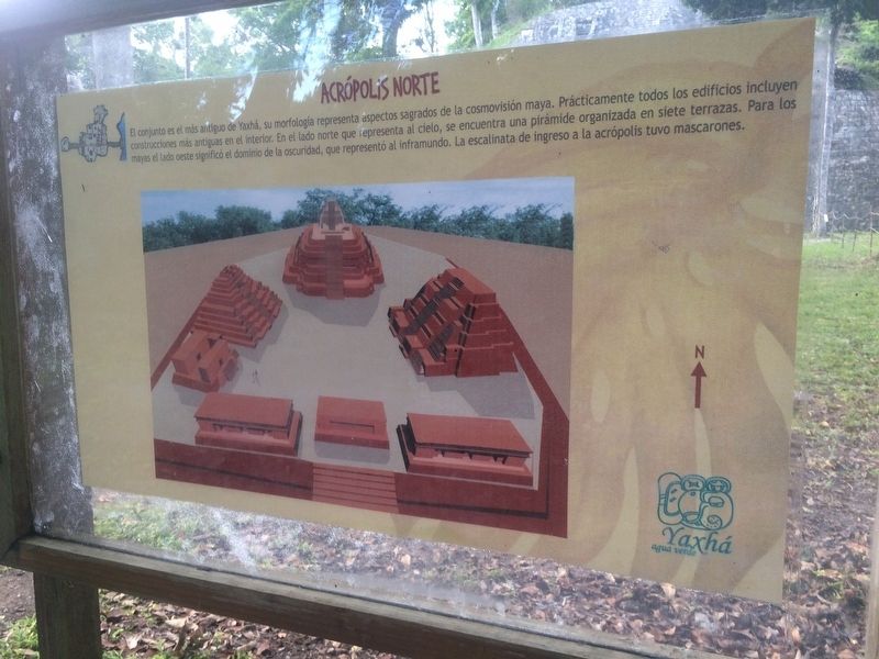
Acrópolis Norte
El conjunto es el más antiguo de Yaxhá, su morfología representa aspectos sagrados de la cosmovisión maya. Prácticamente todos los edificios incluyen construcciones más antigua en el interior. En el lado norte que representa al cielo, se encuentra una pirámide organizada en siete terrazas. Para los mayas el lado oeste significó el dominio de la oscuridad, que representó al inframundo. La escalinata de ingreso a la acrópolis tuvo mascarones.
The North Acropolis
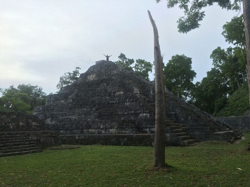
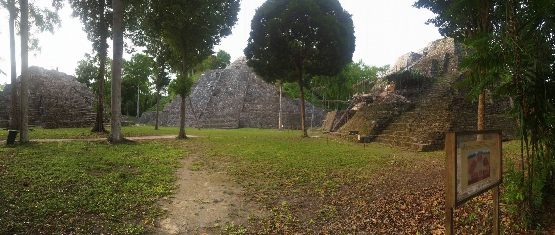
The North Acropolis is the oldest of Yaxhá. Its morphology represents the sacred aspects of the Mayan worldview. Virtually all of the buildings here include older constructions in their interior. The northern side of the Acropolis represents the sky. It is represented by a pyramid organized into seven terraces. For the Maya, the western side represented the power of darkness, which represented the underworld. The stairway entrance to the Acropolis at one time included large plaster and stone masks known as “mascarones.”
Topics. This historical marker is listed in these topic lists: Anthropology & Archaeology • Architecture • Man-Made Features • Native Americans.
Location. 17° 4.551′ N, 89° 24.145′ W. Marker is in Melchor de Mencos, Petén. The marker is in the North Acropolis in Yaxhá Archaeological Park. The park is some 5 kilometers north of the village of El Zapote, turning from the CA13 road. Touch for map. Marker is in this post office area: Melchor de Mencos, Petén 17011, Guatemala. Touch for directions.
Other nearby markers. At least 8 other markers are within walking distance of this marker. The Plaza of the Birds (about 150 meters away, measured in a direct line); The Palace's Ballgame (approx. 0.2 kilometers away); Sacrificial Pyramid (approx. 0.3 kilometers away); Intersection of the Eastern and Quarry Causeways (approx. 0.3 kilometers away); East Causeway Residential Zone (approx. 0.4 kilometers away); The Quarry Causeway (approx. half a kilometer away); Plaza of the Columns (approx. 0.6 kilometers away); The Eastern Acropolis of Yaxhá (approx. 0.6 kilometers away). Touch for a list and map of all markers in Melchor de Mencos.
Photographed By J. Makali Bruton, August 19, 2016
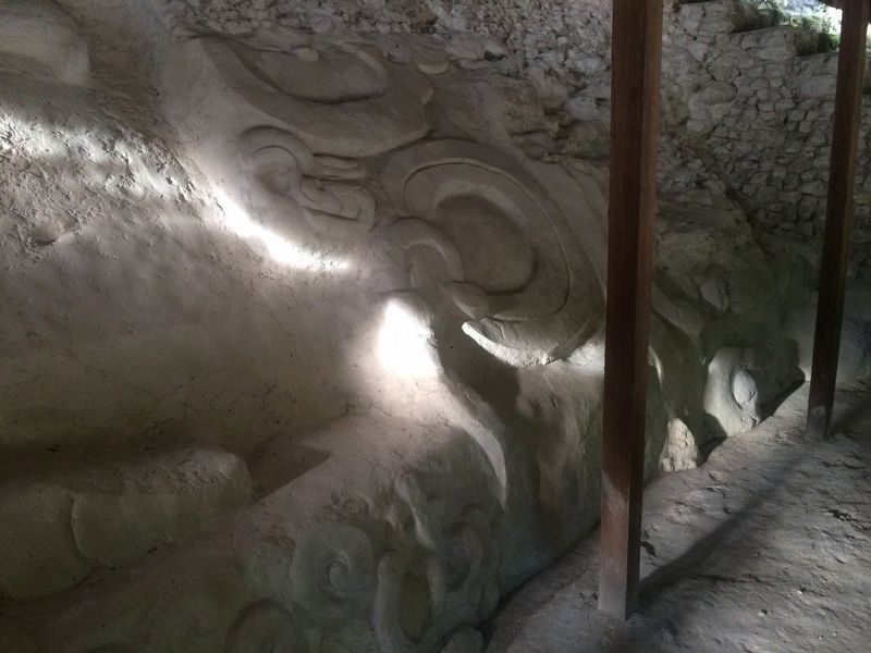
5. A reconstructed 'mascarón' at The North Acropolis at Yaxhá Marker
As the marker mentions, previously the North Acropolis had large, elaborate masks (known as 'mascarones') that lined its entrance. This is an example of a reconstruction of one of the mascarones, made of plaster and stonework. During the time that Yaxhá was inhabited they would have been painted in bright colors.
Credits. This page was last revised on March 2, 2018. It was originally submitted on October 30, 2016, by J. Makali Bruton of Accra, Ghana. This page has been viewed 408 times since then and 27 times this year. Photos: 1, 2, 3, 4, 5. submitted on October 30, 2016, by J. Makali Bruton of Accra, Ghana.
