
Rock Creek Park in Northwest Washington in Washington, District of Columbia — The American Northeast (Mid-Atlantic)
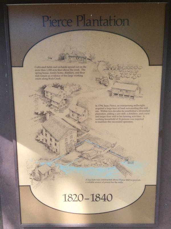
Pierce Plantation
Photographed by J. Makali Bruton, September 18, 2016
1. Pierce Plantation Marker
1820-1840
In 1794, Isaac Pierce, an enterprising millwright, acquired a large tract of land surrounding his mill site. Within two decades he established a diversified plantation, adding a saw mill, a distillery, and a new and larger flour mill to his farming activities. A working household of 26 persons was required to maintain this successful operation.
A log dam was constructed above Pierce Mill to provide a reliable source of power for the mills.
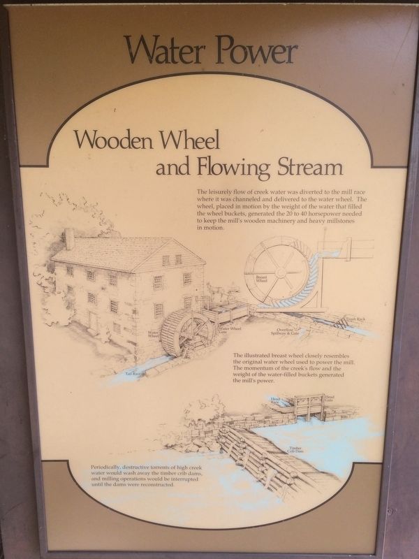
Wooden Wheel and Flowing Stream
The illustrated breast wheel closely resembles the original water wheel used to power the mill.
this page online
Periodically, destructive torrents of high creek water would wash away the timber crib dams, and milling operations would be interrupted until the dams were reconstructed.
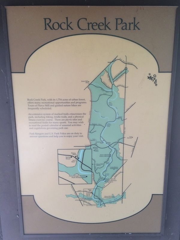
An extensive system of marked trails crisscrosses the park, including hiking, bridle trails, and a physical fitness exercise course. There are picnic sites and recreational fields for many sports. You may wish to read the posted calendar of seasonal activities and regulations governing park use.
Park Rangers and U.S. Park Police are on duty to answer questions and help you to enjoy your visit.
Erected by National Park Service, U.S. Department of the Interior.
Topics. This historical marker is listed in these topic lists: Agriculture • Environment • Industry & Commerce • Settlements & Settlers. A significant historical year for this entry is 1794.
Location. Marker has been permanently removed.
Photographed by J. Makali Bruton, September 18, 2016
2. Pierce Plantation Marker
We have been informed that this marker is no longer there and will not be replaced. This page is an archival view of what was.
Regionally, this marker was in the Washington Metropolitan Area. It was also in the American Northeast, in the Upper South, in the Mid-Atlantic, in the Tidewater, and in the Chesapeake Bay Region. Globally, it was in North America, the Western Hemisphere, the Western World, and the Anglosphere.

Other nearby markers. At least 8 other markers are within walking distance of this location: Orchards, Fields, Gardens, Pastures
Photographed by J. Makali Bruton, September 18, 2016
3. Pierce Plantation Marker
Another marker is no longer nearby. Pierce Mill (was within shouting distance of this marker but has been confirmed missing).
Photographed by J. Makali Bruton, September 18, 2016
4. Pierce Plantation Marker
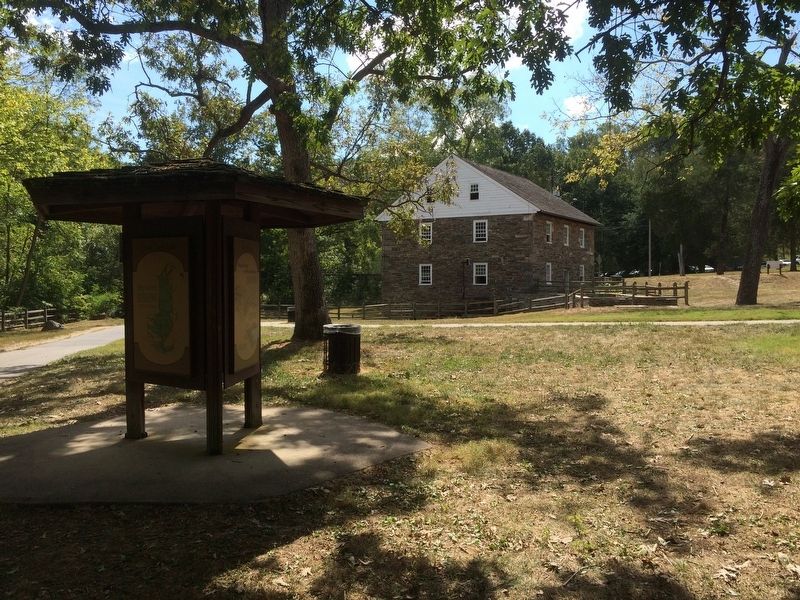
The Peirce Mill can be seen in the background in this view to the south.
Credits. This page was last revised on October 20, 2025. It was originally submitted on November 6, 2016, by J. Makali Bruton of Washington, District of Columbia. This page has been viewed 1,759 times since then and 107 times this year. Photos: 1, 2, 3, 4. submitted on November 6, 2016, by J. Makali Bruton of Washington, District of Columbia.
