Russells Point in Logan County, Ohio — The American Midwest (Great Lakes)
1913 Flood
A History of Indian Lake
Photographed by Rev. Ronald Irick, June 5, 2017
1. 1913 Flood Marker
Inscription.
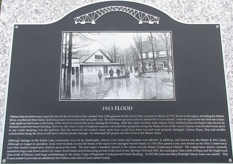
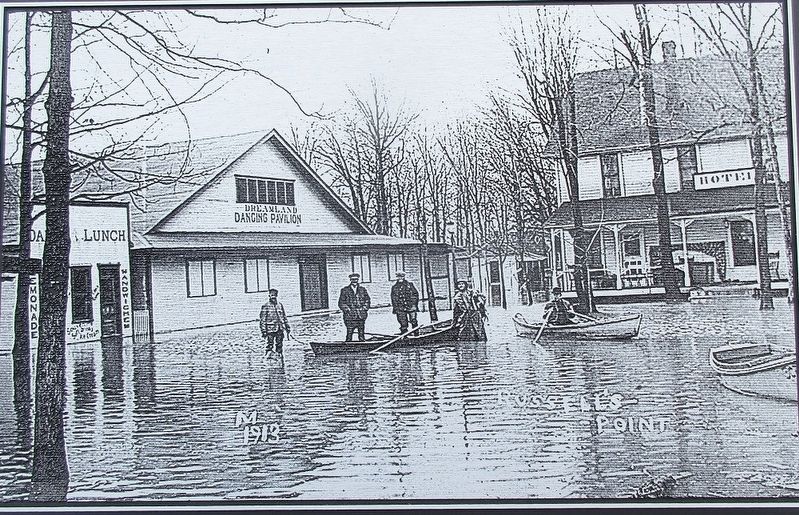
History has recorded many major floods and the devastation they created. One of the greatest floods ever in Ohio occurred in March of 1913. Rivers in the region, including the Great Miami River, overflowed their banks destroying many towns and cities along the way. The still-frozen ground could not absorb the 10-inch rainfall. Some thought at the time that Indian Lake spillway had burst or the banks of the reservoir had eroded away causing the flooding. After the waters receded, many Miami Valley residents believed Indian Lake should be drained to prevent future flooding. However, the Corps of Engineers quickly concluded that properties along the Miami River all the way to Dayton were flooded hours prior to any water escaping over the spillway. Had the reservoir not existed, many more lives would have been lost and more property damaged. Sidney, Piqua, Troy and many smaller communities along the river would have suffered greater damage. An estimated 420 people lost their lives in the Miami Valley.
Although damage in the Indian Lake community was not catastrophic, almost every home and business was effected. In addition,
Click or scan to see this page online
lost forever was the Miami & Erie Canal. Although no longer in operation, locks were washed out and the banks of the canal were damaged beyond repair. In 1914 Ohio passed a law, now known as the Ohio Conservancy Law that created conservancy districts around the state. The first major watershed district in the nation was the Miami Conservancy District. The conservancy district currently maintains large scale flood control dry dams, flood basins and levees along several of the local rivers. Between 1918 and 1921, the Lockington Dam north of Piqua and the Englewood Dam north of Dayton, were huge undertakings of the Corps of Engineers to help prevent future flooding. In 2015 the John and Mary Rudolph Nature Area was created. This 52 acre preserve provides an additional four billion cubic feet of flood control locally.
Erected 2017 by The Indian Lake Historical Society.
Location. 40° 28.372′ N, 83° 53.708′ W. Marker is in Russells Point, Ohio, in Logan County. It
Photographed by Rev. Ronald Irick, June 5, 2017
2. 1913 Flood Marker
is on West Main Street (Ohio Route 366), on the right when traveling west. Marker is in park area on the west side of Russells Point Harbor. Touch for map. Marker is at or near this postal address: 100 West Main St, Russells Point OH 43348, United States of America. Touch for directions.
Regionally, this marker is in the Till Plains. It is also in the American Midwest and in the Corn Belt. Globally, it is in North America, the Western Hemisphere, the Western World, and the Anglosphere. Historically, it finds itself in what was once the Viceroyalty of New France, the Haudenosaunee (Iroquois) Confederacy, the territory of the Mississippian Culture, and the Northwest Territory.
Credits. This page was last revised on June 8, 2017. It was originally submitted on June 8, 2017, by Rev. Ronald Irick of West Liberty, Ohio. This page has been viewed 1,003 times since then and 63 times this year. Photos:1, 2, 3, 4. submitted on June 8, 2017, by Rev. Ronald Irick of West Liberty, Ohio. • Bill Pfingsten was the editor who published this page.